World > Americas > Argentina

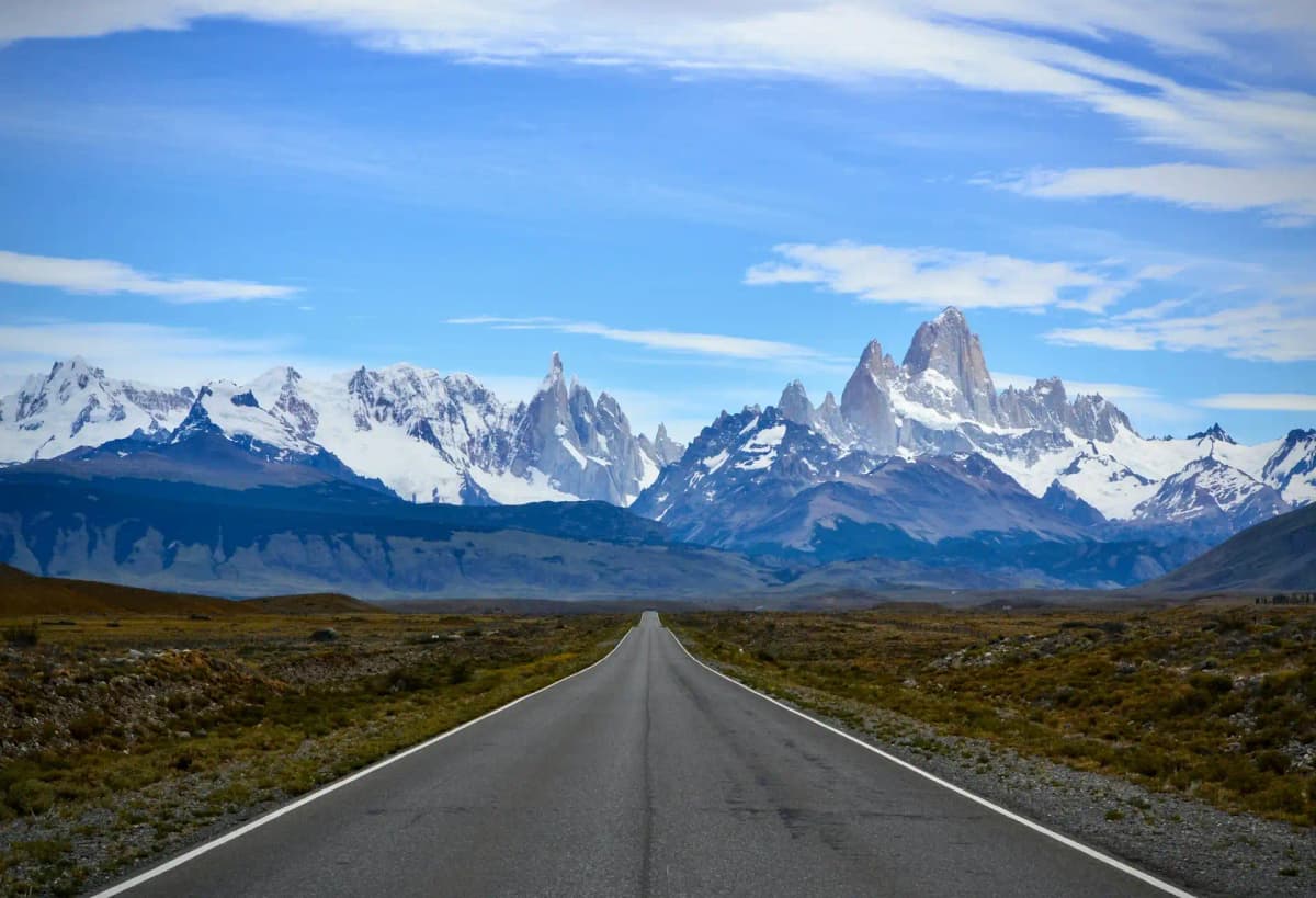
Argentina landscape

Argentina

Explore weather trends, climate data, and curated weather guides for Argentina

Argentina Climate Intelligence

Spanning a huge swathe of South America, Argentina's sheer size guarantees a stunning variety of climates. Experience "opposite seasons" here: generally warm to hot summers (December-February) invite exploration, while mild to potentially frigid winters (June-August) offer different charms, with conditions ranging dramatically from the humid subtropical north to the arid, windswept south of Patagonia. Planning the perfect trip or assessing business conditions? Dive deep into regional insights and annual weather patterns across Argentina on WeatherBox!

Average Temperature & Seasonal Trends in Argentina

How do temperatures shift month-by-month?

Temperature Map

How to Use This Map

  • Watch Seasons Change

    Click the Play button to start an animated timelapse of annual temperature shifts.

  • Explore Month-by-Month

    Drag the slider controls to pause on specific months and visualize detailed conditions.

Key Summary
  • Argentina features a diverse thermal profile that transitions from a humid subtropical climate in the north to subantarctic conditions in the southern reaches.
  • Seasonal variations are most pronounced in the central and southern regions, where diurnal temperature swings and relentless winds significantly influence the daily feel of the air.

Argentina stretches across a vast range of latitudes, which creates a varied thermal profile visible on our WeatherBox maps. In the north, you encounter a humid subtropical environment where the mercury often stays stubbornly high throughout the year. During the summer months from December to February, daytime highs frequently exceed 90 degrees Fahrenheit. This intense heat is often paired with heavy afternoon downpours that provide a brief respite from the stifling humidity. To manage these conditions, many people find that breathable fabrics and midday breaks in shaded or air-conditioned spaces are effective ways to stay comfortable while exploring the lush rainforests or the expansive wetlands. The seasonal variance is less extreme here than in the south, meaning the warmth is a consistent feature for those visiting the northern provinces.

Moving into the central regions, the climate transitions into a more temperate zone with four distinct seasons. In the central plains and the western regions near the mountains, the summer warmth is usually balanced by lower humidity levels than those found in the north. However, the winter months of June through August bring a persistent crispness, with temperatures often dipping toward the freezing point during the overnight hours. Our data at WeatherBox highlights that the western areas experience significant diurnal temperature swings, where a balmy afternoon can quickly turn into a chilly evening as the sun sets behind the peaks. Utilizing a system of versatile layers is a standard approach for those attending outdoor gatherings or touring the vast vineyards to account for these rapid atmospheric shifts and the cool autumnal breezes.

The southern reaches of the country, specifically the rugged expanses of Patagonia, are defined by short summers and lengthy winters. Even during the warmest months, the average daily temperature rarely climbs into the high 60s, and the presence of relentless winds often creates a wind chill that makes the air feel significantly colder than the actual reading. In the winter, frequent snowfall and sub-freezing conditions are the norm across the landscape. WeatherBox charts show that the maritime influence along the southern coasts keeps temperatures slightly more stable than the inland steppes, yet insulated outerwear and windproof gear remain necessary for any outdoor event or sightseeing trip. Monitoring these extreme conditions allows for better preparation when navigating the frigid beauty of the southern glaciers and the windswept plains.

Regional Humidity & Dew Point Patterns in Argentina

How does humidity vary across the country?

Humidity Map

Key Summary
  • Humidity levels vary significantly across Argentina, ranging from the arid west to the subtropical northeast.
  • Summer months typically bring higher moisture levels to the central pampas, while the southern regions remain consistently dry.

When you travel through Argentina, you encounter a wide spectrum of air moisture levels that influence your daily comfort. We track these patterns through our humidity comfort index, which identifies everything from bone-dry environments to muggy subtropical zones. In the northeast, near the Brazilian border, the air is frequently heavy and saturated, creating a lush environment where moisture is a constant companion. In the central plains and the coastal areas, the humidity fluctuates with the seasons. During the summer months, the Atlantic air masses bring a sticky quality to the atmosphere that many find uncomfortable during the heat of the day. Our data at WeatherBox shows that these levels often peak in January, making the air feel thick and warm.

The southern reaches of Patagonia and the high elevations of the Andes mountains offer a crisp and arid experience. The prevailing winds from the west lose their moisture over the mountains, leaving the eastern plains notably dry. We categorize much of this southern territory as dry on our index for the majority of the year. Travelers planning outdoor excursions like hiking or photography find the air rarely feels damp or heavy, even when temperatures are low. During the winter season, the humidity across the central regions tends to drop, leading to bracing and clear days. Coastal fog occasionally introduces a misty quality to the mornings before the sun evaporates the surface moisture.

These moisture trends assist you in preparing for specific regional conditions when organizing events or selecting clothing. If you are heading to the subtropical north, lightweight fabrics that allow for breathability help manage the persistent dampness. For those visiting the central regions in the peak of summer, scheduling outdoor activities for the early morning allows you to bypass the sweltering and oppressive conditions that develop by mid-afternoon. Consulting our comfort index maps helps you identify whether your destination falls into the comfortable green zone or the uncomfortable orange zone. This foresight allows for adjusting your itinerary, such as opting for air-conditioned indoor venues during muggy spells or carrying skin moisturizer for the parched air of the high-altitude deserts.

How to Use This Map

Humidity Comfort Levels
Dry
Comfortable
Uncomfortable
Muggy
Very Muggy
Oppressive
  • Watch Seasons Change

    Click the Play button to start an animated timelapse of annual humidity shifts.

  • Explore Month-by-Month

    Drag the slider controls to pause on specific months and visualize detailed conditions.

  • Find Your Comfort Zone

    Use these insights to identify the ideal time to visit Argentina based on your weather preferences.

Climate Zones of Argentina (Köppen-Geiger Map)

What are the climate zones of Argentina?

Climate Map

Climate Classification Legend

Tropical
Af
Am
Aw
As
Dry
BWh
BWk
BSh
BSk
Temperate
Csa
Csb
Csc
Cwa
Cwb
Cwc
Cfa
Cfb
Cfc
Continental
Dsa
Dsb
Dsc
Dsd
Dwa
Dwb
Dwc
Dwd
Dfa
Dfb
Dfc
Dfd
Polar
ET
EF
Key Summary
  • Argentina’s enormous latitudinal range, from the Tropic of Capricorn to the frigid Southern Ocean, creates climate zones spanning humid subtropical heat to subpolar chill.
  • The towering Andes force moisture-laden Pacific winds to release their rain on the western slopes, casting much of western and Patagonian Argentina into a marked rain shadow.
  • Strong seasonality defines the country, with hot, sticky summers in the central regions and long, cold winters punctuated by snow in the far south.

Argentina’s climate is a story of latitude and mountains. The country extends over 3,700 km from north to south, so you cross several major Köppen climate zones in a single trip. The northeast, including Buenos Aires and the Pampas, lies in a humid subtropical (Cfa) zone, with warm, muggy summers and mild winters. Travel west toward the Andes and you encounter the cold desert (BWk) and cold semi-arid (BSk) regions of the rain shadow, where the air is dry and skies are famously clear. In the far northwest, around Salta and Jujuy, high-altitude valleys moderate the subtropical highland (Cwb) climate, bringing sunny, mild days and cool nights. The Patagonian steppe remains largely semi-arid (BSk), windy and treeless, while the southernmost tip in Tierra del Fuego shifts to a subpolar oceanic (Cfc) climate, often drizzly and raw. Here at WeatherBox, we use these Köppen designations on our maps to help you see at a glance how sharply conditions change across the country.

Seasonal contrasts shape the feel of Argentina’s famous destinations. In the lush northeast, the thundering cascades of Iguazu Falls experience tropical rainfall spread throughout the year, but summer (December to February) brings stubbornly high heat and high humidity that can feel oppressive on walking trails; the drier winter months from May to September offer more comfortable sightseeing. The wine-rich valleys of Mendoza enjoy a dry season with sun-drenched days and cool Andean breezes, ideal for vineyard visits and patio tastings under dazzling blue skies. Head south to Patagonia’s glacier-carved landscapes and you face the region’s famous winds, with summers that are short and relatively mild, peaking around 15°C to 20°C (59°F to 68°F), and winters that plunge below freezing, often dusting the steppe with snow. The Lake District around Bariloche sits in a cooler highland pocket, where lake waters shimmer in the long, golden light of the austral autumn, and spring brings blooming wildflowers across meadows backed by snow-capped peaks. In the far northwest, the colonial streets of cities like Salta bask in a dry winter season with comfortable daytime warmth, while brief summer thunderstorms refresh the red-rock canyons.

When planning your travels, Argentina’s climate suggests packing for variety. The optimal windows for many regions are the shoulder months of October to November and March to April, when central areas and the Lake District offer pleasant temperatures without the fierce summer crowds or peak humidity. For Patagonia, the best conditions cluster between December and February, though you will still need windproof layers and good sun protection because the ozone-thinned atmosphere lets through strong UV. Northern destinations like Iguazu and Salta are most agreeable during their drier, less humid winter from May to September; light breathable fabrics, a raincoat for sudden showers, and sturdy walking shoes serve you well. In contrast, the Pampas and Buenos Aires can be steamy in summer, so packing linen shirts and a hat makes city strolls far more pleasant. Argentina’s climatic diversity is its travel superpower: you can chase crisp autumn colors in the Andean foothills while the far north still basks in spring-like sunshine. We invite you to explore WeatherBox’s charts and Köppen climate map to pinpoint your ideal travel window, season by season.

Find places with your ideal climate

Use our Climate Finder to search and rank locations by their temperature and humidity patterns.

Open Climate Finder

Compare Weather
in Argentina

See how temperatures, sunshine, and rainfall differ between any two locations on Earth

Argentina flag
Buenos AiresArgentina
Change
Argentina flag
CordobaArgentina
Change

Weather Guides

Explore comprehensive annual weather and climate insights for 76 locations in Argentina

Explore other locations in Americas