World > Oceania > Australia

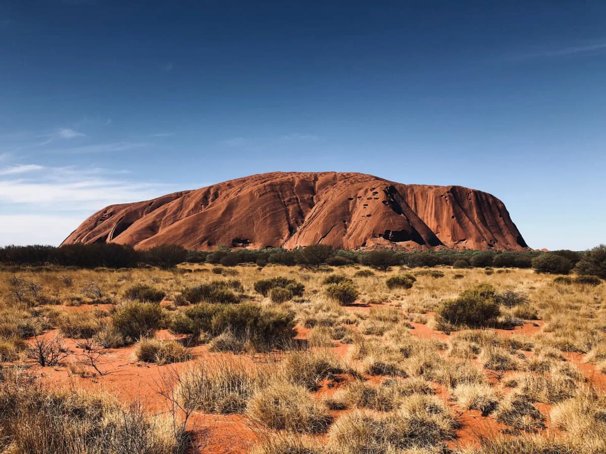
Australia landscape

Australia

Explore weather trends, climate data, and curated weather guides for Australia

Australia Climate Intelligence

Australia boasts a diverse climate, ranging from a tropical north to a temperate south. Expect distinct seasons with warm to hot summers (December-February), mild to cool winters (June-August), and pleasant transitions in between. The northern regions experience a wet and dry season, while the southern regions have more uniform rainfall throughout the year. Planning your next adventure or need data for your business? Dive deeper into Australia's weather patterns and climate insights at WeatherBox - your guide to informed decisions.

Average Temperature & Seasonal Trends in Australia

How do temperatures shift month-by-month?

Temperature Map

How to Use This Map

  • Watch Seasons Change

    Click the Play button to start an animated timelapse of annual temperature shifts.

  • Explore Month-by-Month

    Drag the slider controls to pause on specific months and visualize detailed conditions.

Key Summary
  • Australia spans tropical, desert, and temperate zones, so average temperatures shift dramatically from the steamy north to the cool southern island of Tasmania.
  • The tropical Top End has a hot, humid wet season and a dry season with balmy clear skies, while the desert interior can swing from blistering days to near-freezing nights.
  • The southern coastal cities experience modest seasonal changes, with long warm summers and mild, sometimes rainy winters that rarely see snow.

Australia’s air temperatures trace the arc of a continent spanning tropical to mid-latitude climates. As the WeatherBox average temperature map shows, the warmest region clings to the northern coast year-round, while the southern states and highlands stay noticeably cooler. Seasons run opposite to the north: summer from December to February brings scorching heat inland and to the north, while winter (June–August) delivers snow to alpine peaks and chilly mornings across the south-east. In the tropical far north, Darwin rarely falls below 25°C (77°F) even in its coolest month, yet outback towns can shiver near freezing on clear winter nights. Southern cities like Sydney and Perth reach summer highs of 25°C–30°C (77°F–86°F) but heatwaves can push the mercury past 40°C (104°F) in inland suburbs. Tasmania’s Hobart sits at the cooler extreme, with winter days averaging 12°C–14°C (54°F–57°F) and mild summer highs rarely topping 22°C (72°F).

Three broad zones define the experience. The tropical north’s wet season (November–April) saturates Cairns and Darwin with humidity and temperatures reaching 33°C (91°F) or more, yet the warm ocean still suits reef trips. The dry season (May–October) delivers low humidity and clear skies, creating ideal conditions for snorkelling the Great Barrier Reef or lounging on the Whitsundays’ palm-fringed beaches. Inland, the Red Centre around Alice Springs and Uluru endures summer days above 38°C (100°F) that discourage prolonged midday exposure, but winter brings mild 20°C (68°F) afternoons and cold, star-filled nights ideal for dawn vistas of the rock. The southern capitals offer a gentler four-season cycle. Melbourne’s summer is cooled by bay breezes, while Adelaide and Perth bask in long dry spells ideal for the sun-drenched vineyards of the Barossa and Margaret River. Sydney’s mild harbour-side evenings and Tasmania’s crisp highland air complete the spectrum, and the WeatherBox temperature map shows how quickly the isotherms cool toward the south.

Timing a trip around these rhythms helps you avoid the extremes. Across the south, autumn (March–May) and spring (September–November) provide mild conditions for coastal walks, winery visits, and city sightseeing without intense summer heat. The tropical dry season from May to October is the most favourable window for the Top End and the Great Barrier Reef, when comfortable humidity and gentle breezes prevail. Central Australia’s winter (June–August) offers warm days and manageable cold nights for exploring the outback. Packing should reflect this variety: lightweight cottons, a wide-brimmed hat, and strong sunscreen are year-round essentials. A packable raincoat suits the northern wet season; southern winters and desert nights call for an insulating jacket. Even a summer evening in the Barossa can cool enough for a light jumper. The WeatherBox temperature map helps you pinpoint seasonal nuances, so you can choose regions that match your comfort preferences. Australia’s climate mosaic means there is always a pocket of favourable weather, whether you seek the dry-season clarity of the reef or the crisp, golden light of a southern spring. For monthly averages and detailed travel planning, explore our full collection of Australia temperature maps on WeatherBox.

Regional Humidity & Dew Point Patterns in Australia

How does humidity vary across the country?

Humidity Map

Key Summary
  • Australia’s tropical north swings between a very muggy wet season and a comfortably dry winter, while the south generally stays pleasant year-round.
  • The vast arid interior has low humidity almost all the time, creating a sharp contrast with the steamier coastal fringes.
  • Seasonal shifts are dramatic in the north but muted in southern cities, where humidity rarely becomes oppressive.

Australia’s immense size and varied geography create strikingly different humidity profiles from coast to coast. In the tropical north, a monsoon-driven climate dominates: from November to April, moisture-laden winds off the Timor and Coral Seas push humidity into the very muggy or oppressive range, while the winter months from May to September bring dry, comfortable air and cloudless skies. The southern coastal capitals enjoy a temperate pattern, where ocean breezes keep most days comfortable, with only occasional muggy summer spells. Between these zones lies the great arid interior, a sun-scorched heart where humidity stays stubbornly low, often leaving the air feeling dry even when temperatures soar. Our WeatherBox data and the companion humidity comfort map reveal these broad bands clearly, showing how relief from sticky conditions is never more than a flight or a long drive away.

Regional geography sharpens these contrasts into distinct travel experiences. Along the Queensland coast, warm waters and rainforest-clad mountains trap moisture, making cities like Cairns and the Great Barrier Reef gateway very muggy to oppressive in the wet season; downpours replenish the famously lush Daintree Rainforest boardwalks, yet the dry season offers blissful conditions for reef cruises and island-hopping. Further south, Sydney and the sun-drenched vineyards of the Hunter Valley see uncomfortable humidity only in short summer bursts, with sea breezes often breaking the mugginess. Melbourne, Adelaide and Perth stick even closer to the comfortable range, thanks to cooler Southern Ocean patterns and Mediterranean-style summers, though inland heat can bring a handful of muggy days. In the Red Centre, the dry desert air around Uluru stays dry to comfortable virtually all year, which is why early-morning viewings of the rock’s glow are rarely dampened by stickiness. As the WeatherBox humidity map indicates, the sharpest boundary sits across the Tropic of Capricorn: north of it, humidity defines the seasons; south of it, humidity is rarely a deal-breaker.

Planning around humidity makes Australian travel more enjoyable, and the WeatherBox charts can help you pinpoint optimal windows. For northern icons like the Great Barrier Reef, Kakadu wetlands or the pearling town of Broome, the dry winter season is the gem: generally comfortable humidity, warm days and minimal rain create ideal conditions for snorkelling, scenic flights and open-air markets. Summer in the tropics is genuinely very muggy or oppressive, with monsoonal showers and tropical cyclones occasionally disrupting plans; if you do visit then, pack light breathable fabrics, a sturdy raincoat and plenty of patience for sudden downpours. Southern cities are most pleasant in spring and autumn, when humidity sits in the comfortable band and crowds thin out; a summer heatwave can nudge conditions into muggy territory, so layers, sun protection and a broad-brimmed hat remain essential. The dry interior calls for sun-smart, lightweight gear year-round, with a focus on hydration rather than humidity defence. Whether you seek the coral gardens of the reef or the crisp morning air of a Victorian wine valley, understanding the country’s moisture rhythms puts you ahead of the weather. Explore WeatherBox for deeper humidity data, our comfort index maps and practical travel planning insights.

How to Use This Map

Humidity Comfort Levels
Dry
Comfortable
Uncomfortable
Muggy
Very Muggy
Oppressive
  • Watch Seasons Change

    Click the Play button to start an animated timelapse of annual humidity shifts.

  • Explore Month-by-Month

    Drag the slider controls to pause on specific months and visualize detailed conditions.

  • Find Your Comfort Zone

    Use these insights to identify the ideal time to visit Australia based on your weather preferences.

Climate Zones of Australia (Köppen-Geiger Map)

What are the climate zones of Australia?

Climate Map

Climate Classification Legend

Tropical
Af
Am
Aw
As
Dry
BWh
BWk
BSh
BSk
Temperate
Csa
Csb
Csc
Cwa
Cwb
Cwc
Cfa
Cfb
Cfc
Continental
Dsa
Dsb
Dsc
Dsd
Dwa
Dwb
Dwc
Dwd
Dfa
Dfb
Dfc
Dfd
Polar
ET
EF
Key Summary
  • Australia spans tropical, subtropical, desert, and temperate zones, with the vast arid interior dominated by hot desert (BWh) and hot semi-arid (BSh) climates.
  • The eastern coastal strip benefits from frequent rainfall thanks to the Great Dividing Range, creating a humid subtropical (Cfa) corridor, while the southern fringe enjoys milder oceanic (Cfb) and Mediterranean (Csb) conditions.
  • The tropical north is governed by a powerful summer monsoon, delivering a stark wet season and a gloriously clear dry season, while the interior stays stubbornly hot and dry for most of the year.

Australia’s climate is a story of its geography. As the driest inhabited continent, much of the land sits beneath the subtropical high-pressure belt, which creates endless blue skies but permanent aridity across the Red Centre and Nullarbor. We use the Köppen climate classification on WeatherBox to map this vast weather puzzle. The core is a sprawling hot desert (BWh) , fringed by hot semi-arid (BSh) grasslands and scrub. Sweep north and you enter the tropics, where the summer monsoon reverses the winds and drenches the Top End and Cape York in tropical rainfall, sustaining pockets of tropical rainforest (Af) and a broad tropical savanna (Aw) and monsoon (Am) zone. Down the eastern seaboard, the Great Dividing Range acts like a green spine, wringing moisture from onshore breezes to maintain a humid subtropical (Cfa) climate from central Queensland to Sydney. South of the mountains, Melbourne and Tasmania drift into an oceanic (Cfb) rhythm, while Perth and Australia’s southwest corner bask under a warm-summer Mediterranean climate (Csb) with dry, dazzling summers and mild, rainy winters.

Regional contrasts play out dramatically across the seasons. The tropical north, including Darwin and the Daintree, lives by the monsoon clock: from November to April high humidity and thundering afternoon downpours create steamy tropical rainforests like the Daintree’s fern-choked gullies, but outdoor plans can be washed out. The dry season, from May to October, brings baby-blue skies and low humidity, making it the prime window for snorkelling the calm, crystal-clear waters of the Great Barrier Reef. The eastern capitals of Brisbane and Sydney enjoy warm, wet summers and pleasant, drier winters, ideal for coastal walks and long beach days, though afternoon heat can be sapping. Further south, Melbourne’s oceanic temper offers famously changeable conditions, while the alpine highlands of the Snowy Mountains get frequent winter snow. The harsh hot desert interior demands respect: Uluru blazes under a desert sun, but winter nights are crisp and cold, ideal for stargazing under the Milky Way’s glittering sweep. Across the southwest, the Mediterranean dry summer of Perth pairs cloudless skies with comfortable ocean breezes, while winter rains paint the Margaret River vineyards in soft green.

For travel, timing is everything. Popular southern cities like Sydney, Melbourne, and Perth are at their best in spring (September to November) and autumn (March to May), when temperatures typically range from 15°C to 25°C (59°F to 77°F) and crowds thin. The tropical north shines in the dry season, roughly June to August, with daytime highs around 30°C (86°F) and dazzlingly clear skies, while the wet summer season brings stifling humidity and torrential tropical rainfall that can disrupt roads. The Red Centre is most pleasant in winter, with mild days and cold desert nights; summer is furnace-like and best avoided. In your bag, reach for light, breathable fabrics, a wide-brimmed hat, and high-SPF sunscreen no matter where you go. A rain jacket is worth its weight for the monsoon season or the southern winter. The Mediterranean southwest, with its crisp winter rains, calls for a light layer and an appreciation for lush vineyards. From the dappled, eucalyptus-scented trails of the Blue Mountains to the dry-season dazzle of the Whitsunday Islands, Australia’s climate demands thoughtful planning but rewards with unforgettable skies. Check our detailed climate charts and monthly breakdowns at WeatherBox to lock in your ideal season before you go.
Find places with your ideal climate

Use our Climate Finder to search and rank locations by their temperature and humidity patterns.

Open Climate Finder

Compare Weather
in Australia

See how temperatures, sunshine, and rainfall differ between any two locations on Earth

Australia flag
MelbourneAustralia
Change
Australia flag
SydneyAustralia
Change

Weather Guides

Explore comprehensive annual weather and climate insights for 246 locations in Australia

Explore other locations in Oceania