World > Americas > Barbados

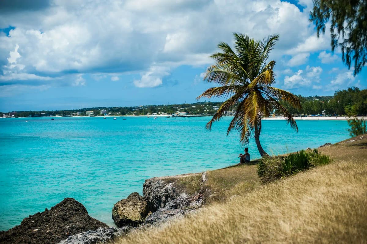
Barbados landscape

Barbados

Explore weather trends, climate data, and curated weather guides for Barbados

Barbados Climate Intelligence

Barbados, a jewel nestled in the eastern Caribbean, offers a delightfully tropical climate year-round. Forget harsh winters and scorching summers; here, you'll find consistent warm temperatures and gentle breezes. Expect a slightly wetter season from June to November, and drier, sunnier days the rest of the year. Planning your perfect Barbadian getaway or need reliable data for your business operations? Explore WeatherBox for in-depth weather insights and start preparing for your trip or business today!

Average Temperature & Seasonal Trends in Barbados

How do temperatures shift month-by-month?

Temperature Map

How to Use This Map

  • Watch Seasons Change

    Click the Play button to start an animated timelapse of annual temperature shifts.

  • Explore Month-by-Month

    Drag the slider controls to pause on specific months and visualize detailed conditions.

Key Summary
  • Barbados enjoys remarkably stable tropical temperatures year-round, with minimal seasonal variation.
  • Gentle northeast trade winds moderate the warmth and create subtle microclimates between the coasts.
  • The WeatherBox temperature map confirms the island’s uniform warmth, with only modest cooling in the higher central interior.

Barbados sits in a classic tropical maritime climate belt, where the surrounding Atlantic Ocean keeps air temperatures in a narrow, balmy band all year. Daytime highs typically range from 29°C to 31°C (84°F to 88°F), while overnight lows rarely slip below 23°C (73°F). The steady northeast trade winds are a defining feature, turning what could be an oppressive heat into something altogether more comfortable. Even during the coolest months, the mercury barely budges, and the island never experiences anything close to a chilly spell. Our temperature map illustrates this uniform warmth vividly, showing little seasonal shift whether you look at January or July data. You can expect sun-drenched mornings and balmy evenings for a beach barbecue or a moonlit walk along the boardwalk without ever needing more than a light wrap.

Though Barbados is compact and mostly low-lying, the island’s gentle topography and coastal orientation do nudge the thermometer slightly. The central highlands, anchored by the Scotland District and Mount Hillaby at around 340 metres (1,115 feet), can be a degree or two cooler than the coast, as indicated by the WeatherBox temperature map. A more noticeable effect comes from the windward east coast, where Atlantic breezes sweep across rugged cliffs and surf-washed Bathsheba, keeping the air feeling refreshingly fresh. In contrast, the leeward west coast, home to the powder-soft sands of the Platinum Coast and calm, glass-clear waters for spotting hawksbill turtles, is more sheltered and can feel a touch more humid. The island has a distinct dry season from December to May, when rain is sparse and sunshine dominates, and a wet season from June to November, when humidity climbs and brief, heavy tropical showers roll through, often in the afternoon. Temperatures during the wet season remain just as warm, but the combination of moisture and sticky air can make midday sightseeing feel draining.

This close relationship between weather and the calendar makes travel planning straightforward. The dry season is the optimal window to visit, offering lower humidity, refreshing trade winds, and a parade of gloriously clear skies for exploring sites like the historic Garrison area in Bridgetown or touring a traditional rum distillery in the cane fields. The wet season is a suboptimal period if you prize unbroken sunshine, yet it still delivers plenty of usable beach days and lighter crowds, often accompanied by lower accommodation prices. Even during these months, the island’s lush Andromeda Botanic Gardens and subterranean Harrison’s Cave remain inviting, though a light raincoat and quick-dry clothing become sensible additions. Year-round, pack breathable fabrics, robust sun protection, and a wide-brimmed hat, as the low-latitude sun is intense. Barbados’s gift is its consistent warmth and the ever-present invitation of the sea. To explore monthly patterns and the subtle regional differences our temperature map reveals, visit WeatherBox for detailed climate charts and further travel planning insights.

Regional Humidity & Dew Point Patterns in Barbados

How does humidity vary across the country?

Humidity Map

Key Summary
  • Barbados enjoys a tropical maritime climate with consistently warm temperatures, but humidity levels vary from comfortable in the dry season to very muggy in the wet season months.
  • The island’s northeast trade winds create a distinct leeward/windward split; the exposed east coast is often breezier and less muggy than the sheltered west coast.
  • As the WeatherBox humidity comfort index map highlights, the highest, most oppressive humidity tends to concentrate along the calm southwestern and western parishes during the summer and autumn.

Barbados sits well inside the tropical Atlantic, where warm ocean waters keep the air loaded with moisture all year. The island’s relative humidity rarely drops low enough to feel genuinely dry, but there is a clear seasonal swing. During the dry season, typically from December through May, brisk northeast trade winds and lower rainfall push the comfort index into a comfortable to muggy range, especially on breezy days. By contrast, the wet season from June to November brings a surge of tropical moisture. Afternoons often see relative humidity climbing between 80% and 90%, producing very muggy to oppressive conditions that feel heavy and still just before the daily downpour. Evenings offer little relief because overnight temperatures stay high, so the air can feel stubbornly muggy deep into the night. We at WeatherBox track these shifts carefully, integrating wind, temperature and humidity into a single comfort index that tells you how the day will actually feel on your skin.

Geography plays an underappreciated role in Barbados’s humidity story. The island is a relatively flat coral limestone platform, yet the relentless northeast trade winds carve out distinct comfort zones. Along the windward east coast in parishes like St. Andrew and St. Joseph, persistent Atlantic breezes wick away moisture and keep the feeling noticeably more comfortable, even when the measured humidity is high. As the WeatherBox humidity map illustrates, this effect weakens dramatically on the sheltered leeward west and southwest coasts, from Speightstown down to Carlisle Bay. Here, calm air allows humidity to pool into very muggy or oppressive levels, particularly around Bridgetown and the upscale Platinum Coast. A slight exception emerges inland over the Scotland District, where higher ground around Cherry Tree Hill and the rugged hills of St. Andrew catches fresher breezes, making a walk through Andromeda Botanic Gardens or a stop at Farley Hill feel less stifling. Underground escapes like Harrison’s Cave also offer a cool, stable environment that sidesteps the surface humidity entirely.

For travellers, the most forgiving period falls between January and April. This is when the dry season, amplified by steady trade winds, delivers long stretches of comfortable humidity ideal for striking out to the wave-lashed east coast or lounging beside the dead-calm Caribbean waters of the west coast. From June onward, humidity nudges higher into very muggy or oppressive territory, and the combination of heat and moisture can make midday sightseeing draining. If you visit during these months, plan active excursions early in the day and seek out the naturally ventilated east-coast spots for a breeze-cooled break. Packing smart means relying on light breathable fabrics, high-factor sun protection, and a lightweight rain jacket for sudden tropical showers. At WeatherBox you can explore our interactive humidity maps, monthly comfort breakdowns, and local index data to shape an itinerary that plays to Barbados’s breezier corners or its sun-soaked calm, depending on the kind of warmth you are chasing.

How to Use This Map

Humidity Comfort Levels
Dry
Comfortable
Uncomfortable
Muggy
Very Muggy
Oppressive
  • Watch Seasons Change

    Click the Play button to start an animated timelapse of annual humidity shifts.

  • Explore Month-by-Month

    Drag the slider controls to pause on specific months and visualize detailed conditions.

  • Find Your Comfort Zone

    Use these insights to identify the ideal time to visit Barbados based on your weather preferences.

Climate Zones of Barbados (Köppen-Geiger Map)

What are the climate zones of Barbados?

Climate Map

Climate Classification Legend

Tropical
Af
Am
Aw
As
Dry
BWh
BWk
BSh
BSk
Temperate
Csa
Csb
Csc
Cwa
Cwb
Cwc
Cfa
Cfb
Cfc
Continental
Dsa
Dsb
Dsc
Dsd
Dwa
Dwb
Dwc
Dwd
Dfa
Dfb
Dfc
Dfd
Polar
ET
EF
Key Summary
  • Barbados has a classic tropical savanna climate (Köppen Aw), defined by a warm, humid year and a pronounced contrast between the dry season and the wet season.
  • Steady northeast trade winds are the island’s natural air conditioner, keeping heat and humidity bearable even in the muggiest months.
  • Being a low coral-limestone island with only modest highlands, Barbados lacks distinct cooler zones and relies on coastal exposure to shape its local wind and wave conditions.

Barbados sits just 13° north of the equator, fully inside the tropics. Its tropical savanna climate (Aw) is typical of many Caribbean islands, with two very different halves of the year driven by the migration of the Intertropical Convergence Zone. Our WeatherBox charts make the rhythm immediately clear: warm to hot temperatures that barely wobble month to month, and a sharp see-saw of rainfall between the dry and wet phases. Daytime highs usually settle between 29°C and 31°C (84°F to 88°F), while nights dip to a comfortable 23°C to 25°C (73°F to 77°F). High humidity is a constant companion, but the dominant northeast trade winds sweep across the island, turning stifling afternoons into breezy, pleasant stretches on the coast. Because Barbados is the easternmost of the Lesser Antilles and largely flat, it’s squarely in the path of those uninterrupted Atlantic breezes. There’s no high-elevation escape from the heat here; the highest point, Mount Hillaby, rises only to 340 metres, so even the interior feels tropical rather than truly cool.

The geography shapes a noticeable coastal divide. The windward east and southeast shores face the full thrust of the Atlantic, so you encounter brisk, persistent winds, wilder sea cliffs, and surf that attracts visitors to spots like Bathsheba for its boulder-strewn beauty and dependable waves. The leeward west and southwest coast enjoys gentle, sheltered Caribbean waters, making it the preferred side for swimmers, snorkellers scanning for sea turtles, and the dazzling white sands around Paynes Bay. Seasonally, the big divide is rainfall. From December to May, the dry season brings long periods of clear, blue-sky days and noticeably lower humidity, with only brief passing showers. From June to November, the wet season takes over, delivering heavy, fast-moving tropical downpours, most often in the afternoon. While the island lies outside the core hurricane belt, the wet months can still produce drenching tropical waves and rough seas. On both coasts the air stays warm, but the windward side’s stronger breezes make even sticky wet-season days feel surprisingly fresh.

For travel, the climate points clearly to the dry season as the most settled window. December through April offers the kind of sunny skies and lower humidity that suit long beach days, catamaran cruises, and exploring plantation grounds without the sudden soakings of wet-season afternoons. This is the busier, higher-priced season for good reason. The wet season, especially from July to November, still has plenty of warm, usable hours for sightseeing – rainfall often comes in brief, intense bursts – but you should expect higher mugginess and the possibility of several-day stretches of overcast, showery weather. May and June sit in a transition zone: a bit more rain than high season, yet often quieter and still very warm. Packing is simple year-round: the essentials are light, breathable fabrics, robust sun protection, a travel umbrella or thin rain jacket, and plenty of insect repellent for the sandflies that thrive in calm, humid air. Barbados’s climate is a simple, honest tropical pattern – a sun-drenched dry season, a sodden but warm green phase, and the ever-present comfort of the trades. For the full monthly breakdown of rainfall, temperatures, and humidity, explore our interactive charts at WeatherBox and fine-tune your plans with data you can trust.
Find places with your ideal climate

Use our Climate Finder to search and rank locations by their temperature and humidity patterns.

Open Climate Finder

Weather Guides

Explore comprehensive annual weather and climate insights for 1 locations in Barbados

Explore other locations in Americas