World > Americas > The Bahamas

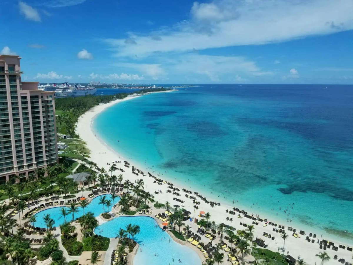
The Bahamas landscape

The Bahamas

Explore weather trends, climate data, and curated weather guides for The Bahamas

The Bahamas Climate Intelligence

Escape to The Bahamas, an island paradise nestled in the Atlantic Ocean southeast of Florida! Here, you'll find a tropical maritime climate boasting warm, sunny weather nearly year-round. The Bahamas experiences a balmy "winter" (November to April), followed by a hotter and more humid summer season (May to October). Interested in planning your perfect Bahamian escape or understanding seasonal impacts for your business? Dive deeper into detailed temperature fluctuations, hurricane season insights, and more at WeatherBox!

Average Temperature & Seasonal Trends in The Bahamas

How do temperatures shift month-by-month?

Temperature Map

How to Use This Map

  • Watch Seasons Change

    Click the Play button to start an animated timelapse of annual temperature shifts.

  • Explore Month-by-Month

    Drag the slider controls to pause on specific months and visualize detailed conditions.

Key Summary
  • The Bahamas enjoys a tropical maritime climate with warm temperatures year-round, typically hovering between 24°C and 29°C (75°F to 84°F).
  • A subtle north-to-south temperature gradient exists, with northern islands like Grand Bahama feeling slightly cooler in winter than the far southeastern cays.
  • The dry season from November to April delivers the most comfortable combination of mild heat, lower humidity, and sunny skies.

The Bahama archipelago stretches across nearly 800 kilometres of the Atlantic Ocean, straddling the Tropic of Cancer. This position gifts the islands a classic tropical marine climate, where temperatures remain pleasant throughout the year and extremes are rare. Even during the coolest months, daytime highs generally reach a comfortable 24°C to 26°C (75°F to 79°F), while summer afternoons typically climb to around 30°C to 32°C (86°F to 90°F). The surrounding shallow, turquoise seas and persistent northeast trade winds work together to moderate the heat, preventing the kind of oppressive stagnation found in some continental tropical destinations. As indicated by the WeatherBox temperature map, the entire country sits within a narrow warm band, yet small shifts are visible when you look closely at seasonal averages across the island groups.

Geography plays a gentle but noticeable role in shaping these temperature patterns. The Bahamas is overwhelmingly low-lying, its highest point reaching just 63 metres on Cat Island, so altitude offers no cooling relief. Instead, the main regional variation comes from latitude. The northernmost islands, including Grand Bahama, Abaco, and the Berry Islands, experience slightly cooler winter nights, with occasional predawn lows dipping to around 17°C (63°F) in January. By contrast, the southern islands such as Inagua and Mayaguana often retain a warmer nighttime cloak, rarely falling below 20°C (68°F) even in mid-winter. The WeatherBox temperature map reveals this gentle thermal slope from northwest to southeast. Seasonally, the divide is more about moisture than temperature. The wet season runs from May to October, when high humidity, frequent afternoon showers, and the potential for tropical storms build over the warm Atlantic waters. The dry season, by contrast, brings fresh breezes, lower humidity, and gloriously clear skies for spotting dolphins around the Exuma Cays.

When you plan a visit, your comfort and the character of your trip will be shaped by this seasonal rhythm. The dry season, roughly November through April, is widely regarded as the most favourable window. Daytime temperatures sit in the sweet spot of 24°C to 28°C (75°F to 82°F), making it ideal for lazy beach days on Harbour Island’s pink sands or snorkelling the Andros Barrier Reef without feeling overwhelmed by heat. This is high season for a reason, and light breathable fabrics, sun protection, and a hat are all you really need. From May onward, the humidity intensifies and afternoon downpours become more frequent, though mornings often remain sun-drenched. The summer and early autumn months also sit within the hurricane season, which can disrupt travel plans. If you pack a rain jacket and stay flexible, you can still find uncrowded resorts and warm seas. Overall, The Bahamas offers a reliably inviting warmth that peaks in freshness from late autumn through spring. To compare temperature patterns across different cays and find the ideal time for your visit, explore the detailed maps and weather charts here at WeatherBox.

Regional Humidity & Dew Point Patterns in The Bahamas

How does humidity vary across the country?

Humidity Map

Key Summary
  • The Bahamas is a low-lying archipelago where persistently moist ocean air keeps humidity high throughout the year, with relative humidity often ranging between 75% and 90%.
  • Cooling northeast trade winds create a noticeable comfort contrast between breezy windward coasts and sheltered leeward shores, as shown on the WeatherBox humidity map.
  • The most comfortable travel window is the dry season from November to April, when humidity eases, while the summer wet season brings oppressive humidity and frequent tropical showers.

The Bahamas sits squarely in the grip of a tropical maritime climate, which means humidity is a constant companion no matter which of the 700 islands you visit. Our data at WeatherBox shows that relative humidity rarely dips below 70%, even during the driest months, and hovers consistently in the 80–90% range during the wet season. Daytime temperatures typically nudge into the upper 20s or low 30s Celsius, and combined with the moisture, the air frequently feels muggy to oppressive. The islands’ geology reinforces this pattern: flat coral limestone terrain offers no elevation to wring moisture from the air or create rain shadows, so the warm surrounding Atlantic feeds the atmosphere with evaporate. Evenings bring only modest relief because the sea surface stays warm year-round, keeping overnight air sticky. You can track this seasonal ebb and flow on the WeatherBox humidity comfort index map, which highlights the swaths of the country that feel genuinely comfortable versus those that stay stubbornly humid.

While these small, low-lying islands don’t generate dramatic regional climate contrasts, the interplay of trade winds and coastal exposure does produce subtle differences you’ll notice on the ground. The prevailing northeast trade winds, strongest from November to April, sweep across the northern Family Islands such as Abaco and Grand Bahama, making beachfront spots feel far more tolerable than the numbers suggest. In contrast, the sheltered western bays of Eleuthera or the mangrove-lined creeks of Andros can trap still, humid air, creating pockets of very muggy conditions even on days that feel fresh on the windward side. The WeatherBox humidity map pinpoints these zones, where wind shadow effects nudge the comfort index down a grade. Visitors exploring the gin-clear waters of the Exuma Cays or lounging on the powder-soft sands of Harbour Island will likely notice that a light onshore breeze can make all the difference between a comfortable afternoon and a sweat-soaked one. Even the southern islands such as Long Island and Inagua, closer to the equator, pick up steady easterlies, but when the wind unexpectedly dies, the air turns heavy fast.

Humidity shapes the rhythm of travel in The Bahamas. The dry season, roughly November through April, delivers the most comfortable window, when relative humidity tends to sit at the lower end of its range and the trade winds reliably keep you cool while sailing, snorkelling the Andros Barrier Reef, or beachcombing along the silky white strands of the Abacos. From May onward, the humidity intensifies, and by June the combination of heat and moisture becomes oppressive, especially during still afternoons that precede a tropical downpour. Packing light, breathable fabrics, plenty of sun protection, and a waterproof layer for passing showers makes even the sticky season manageable, though outdoor sightseeing is best planned for the early morning. Hurricanes and tropical storms, most common between August and October, add an extra layer of uncertainty. Overall, The Bahamas’ humidity profile rewards travelers who time their trip for the winter and early spring breezes. For a deeper look at month-by-month humidity levels and the detailed comfort zones across the archipelago, visit WeatherBox and consult our humidity map before you book.

How to Use This Map

Humidity Comfort Levels
Dry
Comfortable
Uncomfortable
Muggy
Very Muggy
Oppressive
  • Watch Seasons Change

    Click the Play button to start an animated timelapse of annual humidity shifts.

  • Explore Month-by-Month

    Drag the slider controls to pause on specific months and visualize detailed conditions.

  • Find Your Comfort Zone

    Use these insights to identify the ideal time to visit The Bahamas based on your weather preferences.

Climate Zones of The Bahamas (Köppen-Geiger Map)

What are the climate zones of The Bahamas?

Climate Map

Climate Classification Legend

Tropical
Af
Am
Aw
As
Dry
BWh
BWk
BSh
BSk
Temperate
Csa
Csb
Csc
Cwa
Cwb
Cwc
Cfa
Cfb
Cfc
Continental
Dsa
Dsb
Dsc
Dsd
Dwa
Dwb
Dwc
Dwd
Dfa
Dfb
Dfc
Dfd
Polar
ET
EF
Key Summary
  • The Bahamas enjoys a classic tropical savanna climate (Aw), with a sun-drenched dry season and a rainier, more humid summer.
  • Prevailing northeast trade winds help temper the year-round warmth, but flat, low-lying limestone islands offer no cooling elevation.
  • Warm ocean shallows keep air temperatures mild in winter, while the Atlantic hurricane season poses a distinct risk from late summer into autumn.

The Bahamas stretches across sparkling Atlantic shallows just north of the Tropic of Cancer, yet its climate feels purely tropical thanks to the warming influence of the Gulf Stream. The entire island chain falls under the Köppen tropical savanna climate (Aw) classification, meaning temperatures stay consistently warm but rainfall splits into two distinct seasons. The dry season runs from November to April, bringing bright, mostly clear days and refreshing northeast trade winds. The wet season from May to October sees higher humidity and frequent, brief afternoon downpours, often in the form of passing tropical waves. Daytime highs typically range from 27°C to 32°C (81°F to 90°F) year-round, with overnight lows rarely dipping below 17°C (63°F) even in the coolest months on the northern islands.

Because the islands are low coral and limestone platforms with no significant mountains, the climate varies little across the archipelago. Instead, what shapes your experience are the constancy of the trade winds and the minor seasonal differences between the drier northern and more arid southern islands. The northwest, including Nassau and Grand Bahama Island, can occasionally feel the edge of North American cold fronts between December and February, bringing a few breezier, slightly cooler days ideal for strolling the pastel-hued streets of Nassau. The southern Out Islands, such as Great Inagua, lie deeper in the tropics and stay warmer and even sunnier during the dry season. Everywhere you go, the shallow sun-warmed waters surrounding endless cays and sandbars create that trademark Bahamian seascape of dazzling turquoise flats. Steady trade winds make the Abacos and Exumas world-renowned sailing grounds, where the breeze often fills sails from November through July.

For travellers seeking gloriously clear skies and low humidity, the months between December and April are the optimum window. This is when the legendary pink sand beaches of Harbour Island and the calm shallows of the Exuma Cays Land and Sea Park glisten under brilliant sunshine, and the weather feels most comfortable for exploring. The wet season brings higher humidity and the chance of afternoon thunderstorms, and the peak hurricane season from August to October can disrupt travel plans with heavy rain and strong winds. If visiting during summer, pack light, breathable fabrics, ample sun protection, and a light raincoat for quick-drenching showers that often pass within an hour. Check our WeatherBox charts for detailed monthly averages of rainfall and sunshine hours to pick your ideal stretch of calm seas and blue skies. Whether you plan to drift over coral gardens or simply lounge on sun-baked sands, our Köppen-based climate maps give you the clearest picture yet of when the islands truly shine.

Find places with your ideal climate

Use our Climate Finder to search and rank locations by their temperature and humidity patterns.

Open Climate Finder

Compare Weather
in The Bahamas

See how temperatures, sunshine, and rainfall differ between any two locations on Earth

The Bahamas flag
NassauThe Bahamas
Change
The Bahamas flag
LucayaThe Bahamas
Change

Weather Guides

Explore comprehensive annual weather and climate insights for 3 locations in The Bahamas

Explore other locations in Americas