World > Europe > Germany

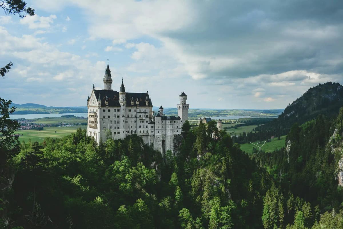
Germany landscape

Germany

Explore weather trends, climate data, and curated weather guides for Germany

Germany Climate Intelligence

Nestled in the heart of Europe, Germany experiences a temperate seasonal climate. Travellers can anticipate cool, often cloudy winters and warm summers, interspersed with mild springs and autumns offering stunning foliage. Planning a trip or need data for your business operations? Unlock in-depth weather insights and historical averages for your specific needs on WeatherBox!

Average Temperature & Seasonal Trends in Germany

How do temperatures shift month-by-month?

Temperature Map

How to Use This Map

  • Watch Seasons Change

    Click the Play button to start an animated timelapse of annual temperature shifts.

  • Explore Month-by-Month

    Drag the slider controls to pause on specific months and visualize detailed conditions.

Key Summary
  • Germany sits in a temperate zone with a clear maritime-to-continental gradient, so winters in the northwest are often milder while the east and south can experience sharper cold.
  • Summer warmth peaks in the Rhine Valley and North German Plain, while the central uplands and Bavarian Alps bring cooler, fresher air even in high season.
  • Spring and autumn deliver the most balanced temperatures for travel, avoiding midwinter chill and the occasional summer heatwaves, as reflected on the WeatherBox temperature map.

Germany’s air temperatures follow a classic four-season rhythm shaped by its position between the North Atlantic and the Eurasian landmass. In a typical year, average lows in deep winter settle between -3°C and 2°C (27°F to 36°F) across much of the country, while summer highs reach a comfortable 20°C to 26°C (68°F to 79°F). The north and northwest benefit from persistent westerly breezes that keep coastal winters less severe and summers slightly cooler, whereas the interior and eastern regions see more pronounced seasonal swings. As indicated by the WeatherBox temperature map, the whole country passes through a distinct warming from March onward, with the thermometer climbing steadily into the peak summer warmth of July and August before a gradual cooling through autumn.

Geography carves out distinct regional flavours. The North German Plain, stretching from the Dutch border to Berlin, enjoys the strongest maritime influence, meaning winter frost is often fleeting and summer afternoons rarely feel oppressive. By contrast, the sheltered Rhine Valley traps heat and can register some of the country’s highest temperatures, with the sun-drenched vineyards around Freiburg and the terraced slopes of the Mosel frequently baking under clear skies. The central uplands, such as the Harz and Thuringian Forest, introduce a cooler, upland climate where crisp air lingers well into spring and snow dusts the higher trails each winter. In the far south, the Bavarian Alps and the Alpine foreland experience the coldest winters and most persistent snow cover, though föhn winds can abruptly raise temperatures by several degrees. Along the Baltic and North Sea coasts, a refreshing sea breeze tempers the midsummer heat, making cities like Warnemünde and Sylt pleasant escapes when inland areas swelter.

For the traveller, these rhythms suggest two optimal windows. Late spring (May to mid-June) and early autumn (September to early October) supply daytime highs mostly between 15°C and 22°C (59°F to 72°F), ideal for unhurried sightseeing along medieval city lanes or cruising the Rhine and Elbe. Light layered clothing, a sun hat, and a rain jacket will handle most conditions during these months. Summer brings longer, warmer days ideal for lake swimming and pavement cafés, but in the Rhine Valley or urban heat islands light breathable fabrics and sun protection become essential. Winter, although cold and occasionally grey, rewards with festive markets and frosted landscapes; a thermal coat, gloves, and sturdy shoes are non-negotiable, especially if you venture into the snowy uplands or the Bavarian Alps. Use the WeatherBox temperature map to compare regional averages before finalising your itinerary. For more detailed monthly breakdowns and travel planning insights, explore our full range of Germany climate data on WeatherBox.

Regional Humidity & Dew Point Patterns in Germany

How does humidity vary across the country?

Humidity Map

Key Summary
  • Germany’s humidity is generally moderate and comfortable, but the maritime north experiences persistently higher moisture than the continental south and east.
  • Summer months can bring muggy conditions to low-lying river valleys like the Rhine and Main, while higher elevations remain fresher.
  • Autumn and spring offer the most balanced humidity for travel, with crisp, dry air ideal for outdoor exploration.

Germany’s central European location yields a temperate climate without extreme humidity, though regional and seasonal shifts matter. Along the North and Baltic Sea coasts, temperate maritime humidity keeps relative humidity in the 70–80% range for much of the year, often with misty mornings that lift only slowly. As you travel inland and south, continental air masses introduce drier winters and more noticeable summer variation. Warm, moisture-laden air from the west can push conditions into uncomfortable or muggy territory, particularly in still weather. The accompanying WeatherBox humidity comfort index map highlights where such mugginess is most likely. Germany rarely sees oppressive humidity akin to the tropics, but a spell of high moisture can sap energy during a day of sightseeing.

Geography strongly moulds these patterns. Northern port cities like Hamburg and Bremen cling to damp, often overcast mornings, while the Rhine Valley, hemmed by the Hunsrück and Taunus ranges, can trap warm, stagnant air in July and August. This creates sticky afternoons for cyclists passing vine-ribboned slopes near Rüdesheim or for walkers in town squares. By contrast, the Alpine Foreland and the higher Black Forest enjoy frequent comfortable humidity, aided by dry Föhn winds that gift clear skies for trails around the Neuschwanstein lookout or ferry rides on Lake Königssee. As shown on the WeatherBox humidity map, the central uplands, including the Harz, sit in a transition zone, offering a pleasant escape from muggy lowland cities during summer.

For visitors, windows of comfortable humidity tend to open from May to early June and again from September to early October. These periods bring mild, balanced air for exploring Berlin’s museum island or taking a river cruise past Dresden’s skyline. High summer (mid-June to August) delivers the warmest days but also stubbornly high humidity in the Rhine-Main region and the capital, where evening air can remain heavy. Winter is dry but cold, with outdoor air rarely straying into the discomfort zone, though heated interiors may feel arid. Pack accordingly: breathable fabrics for muggy days, a raincoat for year-round showers, and layers for crisp spring and autumn mornings. Germany’s generally moderate humidity means that with a little planning, almost every season can be a pleasure. For detailed humidity data and travel planning insights, visit WeatherBox.

How to Use This Map

Humidity Comfort Levels
Dry
Comfortable
Uncomfortable
Muggy
Very Muggy
Oppressive
  • Watch Seasons Change

    Click the Play button to start an animated timelapse of annual humidity shifts.

  • Explore Month-by-Month

    Drag the slider controls to pause on specific months and visualize detailed conditions.

  • Find Your Comfort Zone

    Use these insights to identify the ideal time to visit Germany based on your weather preferences.

Climate Zones of Germany (Köppen-Geiger Map)

What are the climate zones of Germany?

Climate Map

Climate Classification Legend

Tropical
Af
Am
Aw
As
Dry
BWh
BWk
BSh
BSk
Temperate
Csa
Csb
Csc
Cwa
Cwb
Cwc
Cfa
Cfb
Cfc
Continental
Dsa
Dsb
Dsc
Dsd
Dwa
Dwb
Dwc
Dwd
Dfa
Dfb
Dfc
Dfd
Polar
ET
EF
Key Summary
  • Germany’s climate is predominantly Temperate Oceanic (Cfb), with mild, damp winters and warm summers; a Humid Continental (Dfb) zone appears in the east and higher uplands.
  • The North European Plain, central uplands, and the Alps create a mosaic of microclimates, from breezy Baltic beaches to föhn-warmed valleys at the foot of the mountains.
  • Rainfall is distributed evenly through the year, keeping landscapes lush but requiring waterproof layers even in high summer.

Germany sits firmly in the mid-latitudes where westerly winds from the Atlantic dominate, delivering a temperate, changeable climate to most of the country. The primary Köppen classification is Cfb, a warm-summer oceanic zone with no dry season, cool to mild temperatures, and frequent cloud cover. In the east and across the higher reaches of the Central Uplands and the Bavarian Forest, winters grow persistently cold enough to shift into the Dfb (warm-summer humid continental) realm, where snow cover lasts longer and January readings drop noticeably lower. The Bavarian Alps even brush alpine tundra (ET) on their highest summits, but the settled valleys and visitor-friendly plateaus remain firmly within oceanic or continental influences. Our WeatherBox climate charts highlight a gentle temperature gradient from the maritime northwest to the more continental southeast, with moist Atlantic air streaming inland and releasing generous rainfall as it hits the western slopes of the low mountain ranges.

Regional contrasts are shaped by relief and proximity to the sea. The North Sea coast sees fresh summers and persistently grey winter skies, while the sandy Baltic shoreline enjoys slightly sunnier, drier conditions that draw German holidaymakers to its breezy strands. In the southwest, the Rhine Valley and the vineyard-draped slopes of the Moselle sit in a modest rain shadow, producing some of Germany’s warmest, driest pockets and gloriously long afternoons for tasting crisp Rieslings among terraced vines. Southern Bavaria and the Black Forest highlands absorb heavy summer showers and frequent winter snowfall, nourishing dense woodlands and flower-filled meadows that dazzle in late spring. A local curiosity is the Alpine föhn, a warm, dry downslope wind that can abruptly nudge Bavaria’s temperatures upward, melting snow in hours and granting almost springlike spells in the depths of winter. Summer daytime highs in the lowlands typically range from 20°C to 25°C (68°F to 77°F), though the upper Rhine can feel much stickier because stubbornly high humidity lingers after sundown. Winter brings short days and a damp chill, with January values hovering around freezing and lows dipping to -3°C (27°F) in Berlin or well below -5°C (23°F) in alpine towns.

The most rewarding window for roaming the half-timbered lanes of medieval towns or lounging in leafy beer gardens runs from late April through September. Spring blossoms and autumn foliage can be dazzling, yet late autumn often settles into persistent drizzle across the central uplands. Winter transforms the country into a scene of twinkling Christmas markets, but daylight is scant and icy spells are common, so a thick coat, hat, and waterproof footwear become essential. When tracing the Romantic Road or cycling beside the Elbe in summer, pack light layers and a sturdy rain jacket because sunny mornings can quickly give way to brief, sharp showers. The alpine south demands quick-drying fabrics and sturdy waterproof gear even in July. For a deeper look at seasonal rainfall cycles and temperature trends, explore our climate maps and detailed data on WeatherBox.

Find places with your ideal climate

Use our Climate Finder to search and rank locations by their temperature and humidity patterns.

Open Climate Finder

Compare Weather
in Germany

See how temperatures, sunshine, and rainfall differ between any two locations on Earth

Germany flag
BerlinGermany
Change
Germany flag
StuttgartGermany
Change

Weather Guides

Explore comprehensive annual weather and climate insights for 144 locations in Germany

Explore other locations in Europe