World > Americas > Dominican Republic

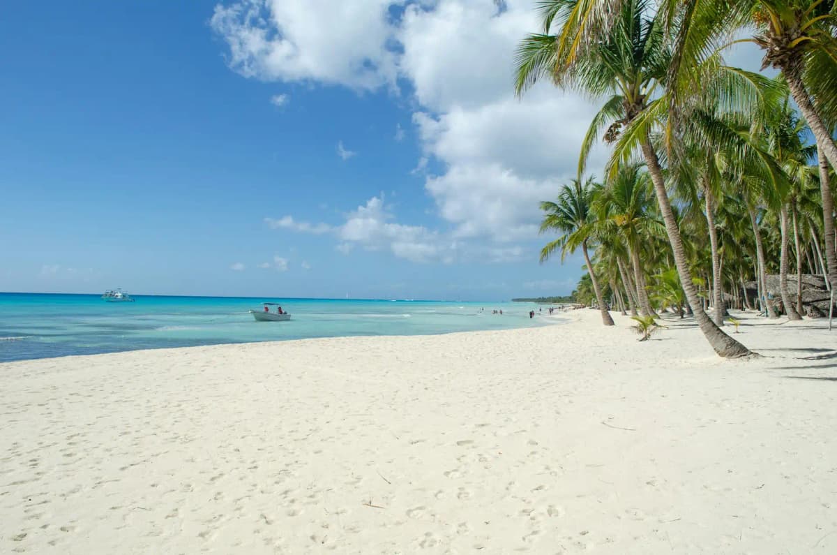
Dominican Republic landscape

Dominican Republic

Explore weather trends, climate data, and curated weather guides for Dominican Republic

Dominican Republic Climate Intelligence

Escape to the Dominican Republic, a Caribbean paradise nestled on the eastern side of the island of Hispaniola! Boasting a tropical climate, the Dominican Republic offers sunshine virtually year-round. Expect warm, humid conditions punctuated by a rainy season from May to November, and a drier, more pleasant season from December to April. Ready to dive deeper into specific regional forecasts and plan the perfect trip or business venture? Explore detailed, up-to-date weather insights on WeatherBox!

Average Temperature & Seasonal Trends in Dominican Republic

How do temperatures shift month-by-month?

Temperature Map

How to Use This Map

  • Watch Seasons Change

    Click the Play button to start an animated timelapse of annual temperature shifts.

  • Explore Month-by-Month

    Drag the slider controls to pause on specific months and visualize detailed conditions.

Key Summary
  • Coastal areas enjoy steady warmth year-round, typically between 25°C and 28°C (77°F–82°F), while interior highlands like Constanza offer cooler relief.
  • The December-to-April dry season brings lower humidity and prolonged sunny spells, making it the most comfortable period for travel.
  • Regional temperature differences are influenced by the trade winds and the Cordillera Central mountain range, with nights cooling noticeably above 1,000 metres (3,280 feet).

The Dominican Republic’s tropical climate delivers perpetual summer-warm air, particularly along the coast. As shown on the WeatherBox temperature map, sea-level locations normally see daytime highs between 27°C and 32°C (81°F–90°F) and overnight lows of 21°C to 24°C (70°F–75°F). Consistent northeast trade winds prevent excessive heat buildup, keeping coastal heat very stable all year. We observe little seasonal temperature swing; instead, humidity and rainfall define the calendar. This means a beach holiday in January feels nearly identical, thermally, to one in July.

Move inland to the Cordillera Central and the picture changes. Towns like Jarabacoa and Constanza, situated above 1,000 metres, see daytime highs of 22°C to 26°C (72°F–79°F) and nights that can cool to around 15°C (59°F), providing a crisp mountain escape. Refer to the average temperature map on WeatherBox to spot this cool interior pocket. Away from the highlands, the dry season from December to April dominates with gloriously clear skies, ideal for lounging on the palm-fringed sands of Punta Cana or exploring the centuries-old stone streets of Santo Domingo’s Zona Colonial. From May to November, the wet season arrives, raising humidity and delivering frequent afternoon downpours that can render rural roads muddy. The northeast coast near Samaná often stays slightly cooler and wetter, its lush hills soaking up moisture that feeds tumbling waterfalls and dense green vegetation.

For those planning a visit, the dry season offers the most comfortable blend of warm sunshine and manageable humidity, drawing visitors to the country’s fabled beaches and historic quarters. The wetter months, though muggier, reward you with a quieter experience and intensely green countryside, but packing a lightweight raincoat and remaining flexible with outdoor plans becomes important. No matter the month, lightweight, breathable clothing, high-factor sunscreen, and a wide-brimmed hat are daily essentials. Mountain evenings may call for a light sweater, but heavy layers are almost never needed. The Dominican Republic’s air temperature remains so consistent that your itinerary rarely encounters a weather-imposed barrier; only the sultry feel of the wet season might alter your comfort. Explore the detailed temperature charts and the average temperature map on WeatherBox to shape a trip that matches your preferred balance of sun and a soft tropical breeze.

Regional Humidity & Dew Point Patterns in Dominican Republic

How does humidity vary across the country?

Humidity Map

Key Summary
  • Dominican Republic’s tropical maritime setting keeps coastal relative humidity stubbornly high, typically between 75% and 90% year-round.
  • The Cordillera Central and other interior highlands bring noticeably lower humidity and cooler breezes, offering pockets of comfort away from the shore.
  • The driest, least muggy window runs from December to April, while the May–November wet season delivers heavier rainfall and an oppressive, very muggy atmosphere.

From the sun-drenched sands of Punta Cana to the misty green slopes of the Samaná Peninsula, the Dominican Republic lives under a blanket of warm, humid air shaped by the Caribbean Sea and the prevailing trade winds. As our data at WeatherBox consistently shows, the country rarely experiences truly dry air. Coastal areas remain immersed in muggy to oppressive humidity almost every month, with morning readings frequently peaking in the 85–90% range before afternoon heating nudges them slightly lower. Even during the relatively refreshing winter dry season, a typical beachside afternoon rarely falls below comfortable, often hovering in the muggy category. This persistent moisture feeds the island’s famously lush vegetation, but it also means that a walk through a historic quarter or a lounge on a palm-shaded beach will almost always come with a noticeable stickiness in the air.

Geography creates welcome relief within a short drive. The country’s spine of mountains, especially the Cordillera Central around Jarabacoa and Constanza, transforms the humidity story entirely. As the WeatherBox humidity map illustrates, these elevated interior valleys sit in a pocket of lower dew points and milder temperatures, frequently rating as comfortable when the coasts are sweltering under very muggy conditions. On the north coast, from Puerto Plata to the Samaná Peninsula, the trade winds pile moisture against the mountains, making even the winter months feel damper and more prone to misty interludes. This feeds the rainforest-draped scenery and lends a soft, dewy light to early mornings in the cacao groves, but it also means the region lingers in the muggy range for much of the year. In contrast, the south and southeast shores, including Santo Domingo’s Zona Colonial and the resort strip around Punta Cana, enjoy a more defined dry season with abundant sunshine and slightly lower humidity, ideal for beachgoers who still find the air thoroughly tropical but less draining than during the summer wet peak.

Travel planning in the Dominican Republic is all about matching your comfort tolerance to the humidity rhythms. The December-to-April stretch offers the most forgiving blend of warm days and a lighter, less oppressive feel, making it the prime season for exploring outdoor colonial landmarks, whale watching in Samaná Bay, or simply enjoying the turquoise shallows of Bavaro Beach without being overwhelmed by mugginess. From May onward, humidity climbs into the very muggy to oppressive range, and the increased rainfall, while often limited to sharp afternoon downpours, drenches the landscape and spikes moisture levels. The upside is fewer visitors and a vivid green countryside that photographers adore. If high humidity leaves you drained, aim for the highlands, where even the rainy season feels far more tolerable. Packing should center on light, breathable fabrics, sturdy sun protection, and a packable rain jacket for those sudden tropical showers. We invite you to explore the detailed monthly charts and the interactive WeatherBox humidity map to compare coastal and mountain zones side by side, helping you pinpoint a travel window that suits your ideal balance of tropical warmth and comfort.

How to Use This Map

Humidity Comfort Levels
Dry
Comfortable
Uncomfortable
Muggy
Very Muggy
Oppressive
  • Watch Seasons Change

    Click the Play button to start an animated timelapse of annual humidity shifts.

  • Explore Month-by-Month

    Drag the slider controls to pause on specific months and visualize detailed conditions.

  • Find Your Comfort Zone

    Use these insights to identify the ideal time to visit Dominican Republic based on your weather preferences.

Climate Zones of Dominican Republic (Köppen-Geiger Map)

What are the climate zones of Dominican Republic?

Climate Map

Climate Classification Legend

Tropical
Af
Am
Aw
As
Dry
BWh
BWk
BSh
BSk
Temperate
Csa
Csb
Csc
Cwa
Cwb
Cwc
Cfa
Cfb
Cfc
Continental
Dsa
Dsb
Dsc
Dsd
Dwa
Dwb
Dwc
Dwd
Dfa
Dfb
Dfc
Dfd
Polar
ET
EF
Key Summary
  • The Dominican Republic has a tropical climate shaped by northeast trade winds, with most regions classified as tropical monsoon (Am) or tropical savanna (Aw) under the Köppen system.
  • Moisture-laden winds collide with mountain ranges, creating lush, rain-soaked northern coasts and a drier, sunnier southwest that sits in the rain shadow.
  • The Cordillera Central highlands rise into a subtropical highland climate (Cfb), offering cool, misty conditions that contrast sharply with the year-round warmth of the beaches.

The Dominican Republic sits squarely in the tropics, yet its climate is far from uniform. Warm to hot temperatures persist all year, but geography carves the country into distinct rainfall regimes. The northern coast and the Samaná Peninsula, exposed to the full force of the northeast trades, fall under tropical monsoon (Am) and even tropical rainforest (Af) classifications, where rain fills the calendar and humidity stays stubbornly high. The south coast, including Santo Domingo and Punta Cana, leans toward tropical savanna (Aw), with a meaningful but not extreme dry season. In the far southwest, a leeward rain shadow produces semi-arid pockets where scrubland and cactus dominate, reflected in border zones of the tropical savanna (Aw) and, in places, a hot semi-arid (BSh) feel. Meanwhile, the high interior plateaus and peaks around Jarabacoa and Constanza shift into a subtropical highland climate (Cfb), where temperatures climb only modestly and nights can feel genuinely cool. Everywhere, the trade winds and the island’s backbone of mountains are the master controls that dictate whether you will encounter exuberant greenery or dazzling, dry skies.

Travel across the Dominican Republic and you will meet these climate zones in quick succession. The windward north coast, home to Puerto Plata and the cloud-drenched rainforests of Los Haitises, experiences frequent showers even during its “drier” period from November to April, while the hurricane season from June to November amplifies rainfall into heavy tropical downpours. In contrast, the southeastern beach belt of Punta Cana and Bayahibe enjoys a well-defined dry season from December through April, when sunshine dominates and afternoon highs typically hover between 27°C and 31°C (81°F to 88°F). This is the prime window for basking on sun-drenched beaches with only occasional brief showers. The rainy season, May to October, brings higher humidity, sudden afternoon thunderstorms, and a calmer, greener landscape; August through October also brings an increased chance of tropical storms. The southwest around Barahona and Lake Enriquillo is the country’s furnace, delivering intense heat that often tops 35°C (95°F) under stubbornly bright skies, paired with very low rainfall. For a complete change of rhythm, the cooler highlands around Jarabacoa and Constanza offer daytime temperatures more like a gentle 18°C to 24°C (64°F to 75°F) and crisp nights, often wrapped in light mountain mist. When packing, light breathable fabrics and strong sun protection are essential for the coasts year-round, while a raincoat and waterproof footwear become critical outside the core dry season. If your plans include the highlands, add a light jacket for drizzle-soaked afternoons and cooler evenings even in summer.

For the traveller, the dry season from December to April is the most comfortable window for classic beach holidays along the southern and eastern shores, with gloriously clear skies ideal for exploring coral reefs and colonial Santo Domingo’s sunlit streets. The wetter months, while muggy and less predictable, reward you with vivid green countryside and fewer crowds on the north coast’s cascade-laced hills. The highlands are pleasant year-round, and the southwest demands early morning excursions to avoid the worst midday heat. We at WeatherBox have mapped the Dominican Republic’s distinct climate quirks with detailed charts and monthly rainfall data, so you can plan around the trade winds and mountain shadows rather than be caught off guard. From the rain-glazed slopes of the Cordillera Central to the arid Enriquillo Basin, the country’s climate offers remarkable variety in a compact space. Explore our resource for a clearer picture before you pack.
Find places with your ideal climate

Use our Climate Finder to search and rank locations by their temperature and humidity patterns.

Open Climate Finder

Compare Weather
in Dominican Republic

See how temperatures, sunshine, and rainfall differ between any two locations on Earth

Dominican Republic flag
SantiagoDominican Republic
Change
Dominican Republic flag
Santo DomingoDominican Republic
Change

Weather Guides

Explore comprehensive annual weather and climate insights for 49 locations in Dominican Republic

Explore other locations in Americas