World > Africa > Egypt

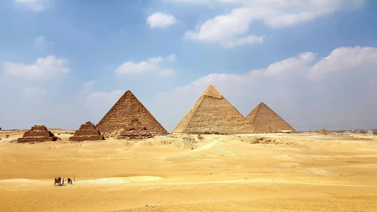
Egypt landscape

Egypt

Explore weather trends, climate data, and curated weather guides for Egypt

Egypt Climate Intelligence

Nestled in Northeast Africa, Egypt predominantly features a hot desert climate characterized by stark contrasts. Expect scorching, sun-drenched summers perfect for coastal relaxation, transitioning into pleasantly mild and dry winters ideal for exploring ancient wonders. Rainfall is minimal year-round, especially inland. Planning the perfect trip or need climate intelligence for business? Uncover detailed weather insights and seasonal patterns for every corner of Egypt on WeatherBox!

Average Temperature & Seasonal Trends in Egypt

How do temperatures shift month-by-month?

Temperature Map

How to Use This Map

  • Watch Seasons Change

    Click the Play button to start an animated timelapse of annual temperature shifts.

  • Explore Month-by-Month

    Drag the slider controls to pause on specific months and visualize detailed conditions.

Key Summary
  • Egypt’s climate is dominated by a hot desert regime, with intensely hot summers and mild, sunny winters, as clearly illustrated on the WeatherBox temperature map.
  • The narrow Mediterranean coastline enjoys a milder, more humid pattern, while inland and southern regions experience soaring temperatures and stark day-to-night swings.
  • Spring and autumn offer the most comfortable travel conditions, avoiding the extreme summer heat that grips the Nile Valley and interior deserts.

Air temperature across Egypt follows a rhythm shaped by its vast desert expanses and the moderating influence of the Mediterranean Sea in the far north. Most of the country sits under a scorching summer heat that typically lasts from May through September, with daytime highs in the interior commonly ranging from 35°C to 42°C (95°F to 108°F). Refer to the WeatherBox temperature map and you will see a sharp contrast emerge: coastal cities such as Alexandria and Port Said usually stay several degrees cooler, with summer highs more often between 28°C and 33°C (82°F to 91°F). Winter, by contrast, brings widespread relief. From December to February, daytime temperatures in Cairo and the Nile Delta range from about 18°C to 24°C (64°F to 75°F), while nights across the entire country can turn surprisingly cool, dipping into single digits Celsius (40s Fahrenheit) in open desert areas. The dry season spans the whole year, with negligible rainfall outside the Mediterranean strip, meaning travellers almost never need to worry about rain disrupting plans beyond a light coastal shower in winter.

Geography carves Egypt into distinct temperature zones that any visitor should understand. The Mediterranean coast, including Alexandria and the fertile Nile Delta, benefits from onshore breezes that keep the air more humid and notably cooler in summer, a fact the WeatherBox temperature map makes immediately apparent. Moving up the Nile Valley, the landscape becomes a narrow green ribbon hemmed in by stone desert. In Luxor and Aswan, blazing summer heat can push afternoon highs well beyond 40°C (104°F), but the exceptionally low humidity and the river’s presence can make early mornings and evenings comparatively bearable. The cooler winter nights in this region are ideal for wandering open-air temple complexes under gloriously clear skies, and daytime conditions are often delightfully warm. Along the Red Sea, year-round warmth attracts beachgoers, with summer peaks tempered slightly by the sea, though the heat still demands caution. Even in the Sinai interior, nights can be chilly in the colder months, a sharp contrast to the daytime sun. The short transitional seasons see occasional khamsin winds that push dust and spike temperatures briefly, though these episodes rarely persist.

For travelling to Egypt, the rhythm of the thermometer is your most useful planning tool. The optimal travel windows are spring, roughly March to April, and autumn, through October and November, when daytime temperatures are warm but not punishing, and nights remain comfortable for evening strolls along the Nile or al-fresco dining. The summer months, particularly June and July, represent the suboptimal season for most sightseeing, especially at inland archaeological sites where the heat can be draining. Coastal retreats along the Red Sea or Mediterranean shore remain more viable, but even there, sun protection and light breathable fabrics become non-negotiable. Winter brings some of the most agreeable daytime conditions for exploring Cairo or the pyramids, with little more than a light jacket needed for after-dark excursions. Stepping further south to Aswan in December or January, however, may still call for sunscreen and a hat during the day and a warm layer when the desert chill sets in. We recommend using the detailed WeatherBox temperature map to compare regions before you book, and packing accordingly: loose cotton clothing, high-SPF protection, and a versatile jacket for cooler desert evenings. Egypt’s climate rewards those who align their travel with the temperature, and our charts are built to help you do exactly that. Explore more temperature data and planning insights on WeatherBox.

Regional Humidity & Dew Point Patterns in Egypt

How does humidity vary across the country?

Humidity Map

Key Summary
  • Egypt’s interior desert regions stay dry year-round, but the Mediterranean and Red Sea coasts experience a sharp seasonal rise into muggy and even oppressive humidity during summer.
  • The Nile Valley and Delta see slightly elevated moisture levels compared to the surrounding Sahara, creating pockets of uncomfortable air in peak summer even as the desert remains bone-dry.
  • A clear travel window from October to April offers comfortable humidity across the country, while the June-to-September stretch brings a split between dry inland heat and sticky coastal conditions.

Egypt’s relationship with humidity is defined by the naked contrast between its vast, sun-scorched deserts and its narrow coastal fringes. The interior, anchored by the Western Desert and the arid mountains of the Eastern Desert, is one of the driest places on Earth, where relative humidity routinely hovers in the dry category, often below 20–30%. This changes dramatically the moment you approach the sea. As the WeatherBox humidity map illustrates, a ribbon of higher moisture clings to the Mediterranean shore from Alexandria to Port Said, and traces the sinuous coastline of the Red Sea down to Marsa Alam. Here, evaporation from the warm waters loads the air with moisture, swinging conditions from comfortable in winter to very muggy or oppressive in the height of summer, when figures can climb into the 70–90% range. The result is a land of two faces: one where a parched breeze feels almost weightless, and another where the air turns thick and clinging.

Geography shapes these patterns with startling simplicity. The Mediterranean coast, including the storied city of Alexandria, endures a classic maritime rhythm. Winter brings mild, comfortable air that pairs beautifully with walks along the Corniche, but from June to September, the combination of inland heat and sea moisture pumps humidity into the uncomfortable to oppressive zone, often leaving the streets draped in a visible haze. Further south along the Red Sea, resorts like Hurghada and Sharm El-Sheikh sit in a transitional belt. The sun-scoured desert backdrop result in that mornings can still feel dry, yet by afternoon the sea breeze injects a sticky edge into the atmosphere, making it feel muggy even for shorts-and-sandals lounging by the coral-rich waters. Inland, the story flips. Cairo, straddling the Nile, picks up a subtle urban and irrigated-field breath that nudges summer afternoons into uncomfortable territory, but once you travel to Upper Egypt and the timeless temple complexes of Luxor and Aswan, you enter a realm of true dryness. There, relative humidity frequently drops to single digits, meaning even blistering 40°C days feel less oppressive than a far milder but sopping-wet afternoon on the coast. Refer to the WeatherBox humidity map to see how sharply these inland dry zones stand apart from the moisture-laden coastal strips.

For travel planning, this humidity divide turns the calendar into a clear decision-making tool. The prime season runs from October to April, when humidity levels nationwide settle into dry and comfortable ranges. This is the moment for crisp, sun-blessed mornings at the Pyramids, pleasantly cool nights on a Nile felucca, and clear skies tracing the ancient carvings in the Valley of the Kings. Late spring and summer, by contrast, test your tolerance. The interior deserts around Siwa or the White Desert stay dry and manageable if you are prepared for extreme dry heat, but the Red Sea and Mediterranean coasts can feel stiflingly muggy, with humidity amplifying the heat into something draining. Packing adjusts accordingly. Year-round, you will want loose, breathable fabrics and robust sun protection. If your journey includes a summer coastal stop, expect that heavy-air feeling and prioritize lightweight, moisture-wicking clothing, plus plenty of water. A light layer for winter evenings, especially in desert camps, rounds out a versatile bag. Egypt’s climate personality is all about where and when you stand: crystal-clear dry air in the right season delivers some of the world’s most rewarding ancient wonders, while an ill-timed coastal visit can leave you bathed in damp, heavy heat. For deeper humidity data tailored to your itinerary, explore the tools and maps on WeatherBox.
How to Use This Map

Humidity Comfort Levels
Dry
Comfortable
Uncomfortable
Muggy
Very Muggy
Oppressive
  • Watch Seasons Change

    Click the Play button to start an animated timelapse of annual humidity shifts.

  • Explore Month-by-Month

    Drag the slider controls to pause on specific months and visualize detailed conditions.

  • Find Your Comfort Zone

    Use these insights to identify the ideal time to visit Egypt based on your weather preferences.

Climate Zones of Egypt (Köppen-Geiger Map)

What are the climate zones of Egypt?

Climate Map

Climate Classification Legend

Tropical
Af
Am
Aw
As
Dry
BWh
BWk
BSh
BSk
Temperate
Csa
Csb
Csc
Cwa
Cwb
Cwc
Cfa
Cfb
Cfc
Continental
Dsa
Dsb
Dsc
Dsd
Dwa
Dwb
Dwc
Dwd
Dfa
Dfb
Dfc
Dfd
Polar
ET
EF
Key Summary
  • Egypt’s climate is overwhelmingly a hot desert climate (BWh), with cloudless skies, extreme summer heat, and very little rainfall, while a narrow slice of the Mediterranean coast enjoys a hot-summer Mediterranean climate (Csa) with mild, wet winters.
  • The country’s geography pits the sprawling Sahara and Eastern deserts against the life-giving Nile Valley and the moderating influence of the Red Sea and Mediterranean shorelines, creating stark contrasts between interior and coast.
  • Comfortable travel hinges on the October to April window, when daytime warmth is pleasant for exploring ancient sites, while June through August delivers dangerously high temperatures away from coastal breezes.

Sitting at the crossroads of North Africa and the Middle East, Egypt’s climate is dictated by its position within the subtropical high-pressure belt and the immense expanse of the Sahara. The dominant Köppen BWh (hot desert) classification covers the vast interior, the Nile Valley, and the Sinai Peninsula. Here, air is relentlessly dry, annual rainfall rarely exceeds a few millimetres, and summer temperatures routinely soar above 38°C (100°F). Sunshine hours are year-round, which is why our WeatherBox charts show such strikingly flat precipitation lines and stubbornly high summer peaks. The sole exception to this arid blanket is the northernmost coastal fringe, stretching roughly from Alexandria to the Libyan border, officially classified as Csa (hot-summer Mediterranean) . In this narrow band, a seasonal rhythm of winter storms brings modest but meaningful rainfall between November and February, tapping into the same mid-latitude weather systems that water southern Europe. Moving east, the coastal strip quickly transitions into semi-arid steppe near the Suez before the desert reclaims the land entirely.

This climatic skeleton creates sharp regional personalities that are essential for travellers to understand. The Mediterranean coast enjoys relatively gentle summers where average highs sit around 30°C (86°F) and winter nights can dip to a cool 10°C (50°F), making Alexandria’s corniche and Roman ruins pleasant for strolls well into late spring. The Nile Valley, from Cairo south to Aswan, is the heart of the intense BWh zone. Humidity is negligible, but from May to September the afternoon heat can feel searing, with Luxor’s open-air temples and the Valley of the Kings baking under almost cloudless skies. Cooler conditions arrive with the winter months, when Luxor and Aswan enjoy gloriously sunny and mild days ideal for cruising the Nile or photographing the temples of Karnak without wilting. The Red Sea coast and southern Sinai share the desert classification but benefit from a maritime afternoon breeze, keeping summer heat just a touch less oppressive than the interior. Saint Catherine, tucked high in the mountainous interior of Sinai, is a notable high-elevation outlier where nighttime winter temperatures can drop near freezing, a stark contrast to the coastal resorts of Sharm El Sheikh. Throughout the country, the khamsin wind occasionally blows in from the desert in spring, raising dust and spiking temperatures for a few days.

For travel planning, the calendar splits decisively at May and October. The prime season from October to April delivers the best balance. You can comfortably marvel at the dazzling desert clarity around the Pyramids of Giza, explore Luxor’s colossal colonnades under warm but manageable sun, or snorkel over the coral gardens of the Red Sea when waters are calm and viz is high. A light jacket or shawl is advisable for cooler evenings in the Mediterranean north and desert nights. From June onward, the summer heat dominates and can be genuinely limiting. Cairo becomes laden with mid-30s°C (90s°F) afternoons, while Aswan and Luxor can push past 40°C (104°F) relentlessly. Unless you restrict yourself entirely to a coastal resort where the sea breeze helps, touring inland monuments becomes an exercise in endurance. Pack accordingly: light, breathable fabrics and robust sun protection are non-negotiable year-round, and a raincoat is only worth considering if you plan to be in Alexandria during a winter visit. Ultimately, Egypt’s climate is one of magnificent extremes, offering sunshine and dramatic desert warmth through the cooler half of the year, and a sharp dose of Saharan reality when the summer sun takes hold. Explore our detailed Egypt temperature and precipitation maps on WeatherBox to choose the ideal window for your journey.

Find places with your ideal climate

Use our Climate Finder to search and rank locations by their temperature and humidity patterns.

Open Climate Finder

Compare Weather
in Egypt

See how temperatures, sunshine, and rainfall differ between any two locations on Earth

Egypt flag
CairoEgypt
Change
Egypt flag
AlexandriaEgypt
Change

Weather Guides

Explore comprehensive annual weather and climate insights for 70 locations in Egypt

Explore other locations in Africa