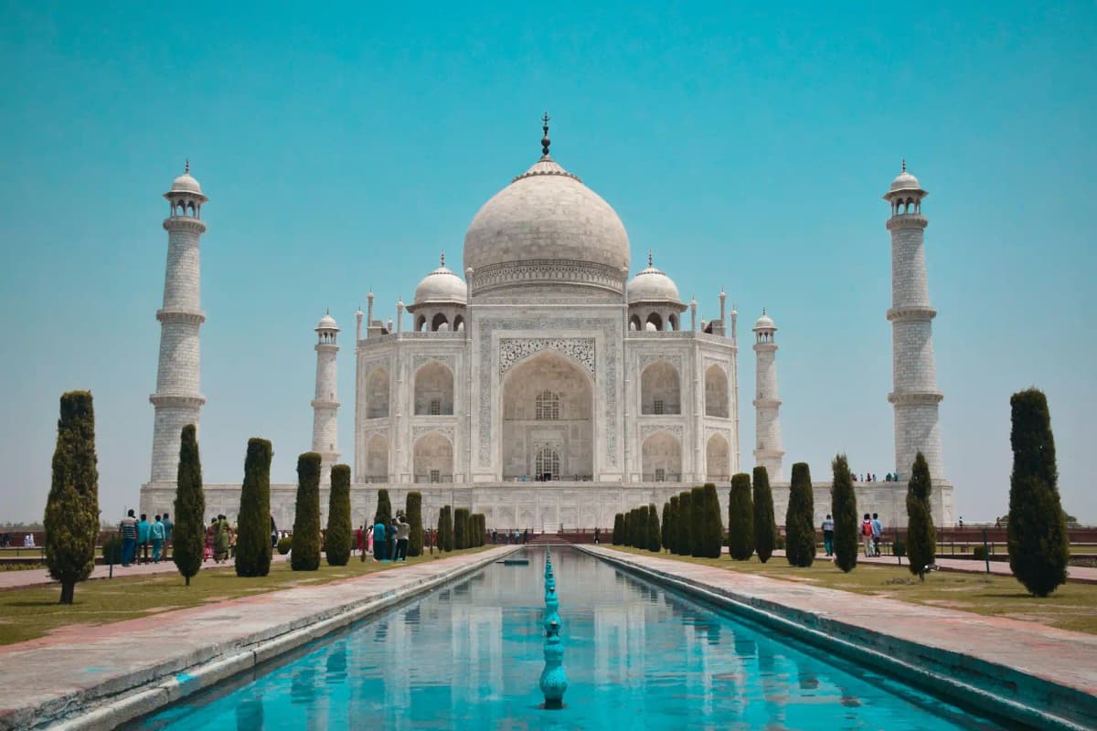
World > Asia > India

India landscape

India

Explore weather trends, climate data, and curated weather guides for India

India Climate Intelligence

Nestled in the heart of South Asia, India presents a dramatically diverse climate, primarily defined by its powerful monsoon system. Experience the rhythm: scorching pre-monsoon summers build intensity before yielding to the vital, drenching monsoon rains (typically June-September), followed by pleasant post-monsoon autumns and cooler, drier winters (especially pronounced in the north). This distinct seasonal cycle profoundly impacts everything from agriculture to travel. Ready to navigate India's weather complexities for your trip or business venture? Explore detailed regional weather data and climate insights on WeatherBox!

Average Temperature & Seasonal Trends in India

How do temperatures shift month-by-month?

Temperature Map

How to Use This Map

  • Watch Seasons Change

    Click the Play button to start an animated timelapse of annual temperature shifts.

  • Explore Month-by-Month

    Drag the slider controls to pause on specific months and visualize detailed conditions.

Key Summary
  • India’s vast geography creates three broad temperature zones, from the tropical south to the arid western plains and the chilly Himalayan north.
  • A dominant monsoon rhythm splits the year into a sweltering pre-monsoon spring, a rain-lashed summer, and a mild, dry winter.
  • Regional extremes are striking, with northern interiors often exceeding 45°C (113°F) in May while high-altitude towns can dip near freezing in December and January.

India’s air temperatures follow a dramatic annual cycle that hinges on the monsoon. Broadly, the year breaks into three periods. From March into May, the land heats up fiercely under clear skies. By late spring, much of the interior bakes, and the approach of the rains brings stifling humidity to many regions. The southwest monsoon then arrives in June, sweeping across the subcontinent and delivering heavy rainfall that sharply lowers daytime highs but keeps the air steamier. Once the monsoon retreats in September, a post-monsoon warmth lingers before a cooler, more comfortable winter settles in from November to February. As indicated by the WeatherBox temperature map, the country’s thermal contrasts in any given month are remarkable: while northern plains shiver under crisp winter air, southern coasts and island groups remain balmy.

These temperature differences are carved by India’s physical geography. The towering Himalayas in the north block cold Central Asian winds during winter, yet also trap roasting heat on the Gangetic Plain before the monsoon. In cities like Delhi and Agra, pre-monsoon temperatures routinely climb to 40°C–45°C (104°F–113°F), making sightseeing at the Taj Mahal or Rajasthan’s forts a test of endurance. In contrast, the coastal margins of Kerala and Goa, fringed by the Arabian Sea, see more moderate but stickier ranges of 28°C–35°C (82°F–95°F) for much of the year. The cooler highlands provide a true reprieve. Hill stations such as Darjeeling, nestled among drizzle-soaked tea plantations, offer summer highs of only 15°C–25°C (59°F–77°F). South India’s Western Ghats and the Deccan Plateau experience a slightly gentler heat. In the far northwest, the Thar Desert endures blazing days and chilly nights, while the far northeast and the Andaman Islands stay warm and humid year-round. When you consult the WeatherBox temperature map, these regional patterns become a practical tool for choosing your route.

For travel, the most comfortable conditions generally stretch from October to March, outside the intense heat and heavy monsoonal downpours. During this cooler, dry season, northern destinations like the Golden Triangle deliver gloriously clear skies for viewing iconic landmarks without the haze. Southern beaches and backwaters remain warm and inviting, with daytime temperatures typically 28°C–32°C (82°F–90°F). April and May are the hardest months for lowland travel, when scorching temperatures make urban exploration draining; a visit in this window usually calls for light, breathable fabrics, abundant sun protection, and an itinerary paced around the early mornings. The monsoon months from June to September transform the landscape into a lush green world, but you will encounter frequent downpours and potential travel disruptions, so a sturdy raincoat and waterproof footwear become key. Packing for India often means strategic layering, especially if your journey spans the warm coastal south and a cooler highland overnight. To map these rhythms onto your own plans, we invite you to explore the detailed monthly breakdowns and interactive tools available on WeatherBox.

Regional Humidity & Dew Point Patterns in India

How does humidity vary across the country?

Humidity Map

Key Summary
  • India’s humidity is dominated by the summer monsoon, which brings a surge of moisture-laden air from June to September.
  • Coastal regions and the northeast endure very muggy to oppressive conditions for much of the year, while the Thar Desert remains dry except during brief monsoon spells.
  • The Himalayan foothills and hill stations offer a comfortable humidity refuge, even as the lowlands swelter.

India’s humidity narrative is a story of two distinct phases: the parched continental air of winter and the saturated monsoon currents of summer. For most of the country, the humidity comfort index swings sharply between these extremes. From October to May, vast stretches of the interior and north bask under dry or comfortable conditions, with relative humidity often dipping below 30 to 40 percent in the northwestern deserts. Then, as summer heat builds, the southwest monsoon arrives, typically in early June. This annual weather engine pumps moisture from the Arabian Sea and Bay of Bengal deep inland, pushing humidity into the muggy, very muggy, or even oppressive categories. Coastal cities like Mumbai and Chennai never truly escape the moisture; even in the nominal dry season, sea breezes keep them in a muggy embrace. The WeatherBox humidity map captures this seasonal transformation clearly, showing how zones of sticky discomfort expand across the subcontinent.

Geography sculpts these humidity patterns into sharp regional contrasts. The Western Ghats act as a colossal humidity trap, forcing monsoon winds to rise and release staggering rain, leaving the coastal plain from Kerala to Maharashtra drenched and very muggy. This is the land of mist-swirled tea plantations in Munnar and golden beaches in Goa, where humidity can feel dense and sticky. The northeast, squeezed between the Himalayas and the Bangladesh delta, endures some of the planet’s most persistently oppressive moisture; the drizzle-soaked tea gardens of Assam and the rainforests of Meghalaya rarely see a truly dry day. Inland, the Indo-Gangetic plain swings from dry winter air to very muggy summer spells where relative humidity hovers between 70 and 90 percent. By contrast, the Thar Desert in Rajasthan remains stubbornly dry for most of the year, its sand dunes and fortress cities basking under clear, low-humidity skies, except when the brief monsoon brings a few weeks of uncomfortable stickiness. The Himalayan belt, including Darjeeling, Shimla, and Manali, sits at altitude where cooler temperatures keep humidity in the comfortable range even when monsoon clouds roll in. As highlighted on the WeatherBox humidity map, the deep coastal bands and the northeastern salient are locked in shades of muggy to oppressive for much of the year, while interior plateaus can flirt with comfortable spells.

For travel planning, these rhythms create a clear window. The most comfortable period for exploring the Golden Triangle of Delhi, Agra, and Jaipur or the beaches of Goa runs from October through March, when winter air leaves much of the country in the dry or comfortable zone. This is the season for marvelling at sun-baked Mughal architecture and strolling through spice markets without a constant film of sweat. Starting in April, interior temperatures climb, and coastal humidity becomes muggy, making extended outdoor sightseeing less pleasant. The monsoon months from June to September turn much of the country very muggy or oppressive, yet they transform the landscape into vivid green splendour, the backwaters of Kerala are lush and the hill stations, with their comfortable humidity, come into their own. If you pack for these conditions, light, breathable cotton and sun protection suit the dry season, while a sturdy raincoat and quick-dry fabrics are indispensable for monsoon travel. India’s vastness means you can find a comfortable pocket in almost any month, but timing a visit to the dry winter months rewards you with the easiest outdoor exploration. Explore WeatherBox for granular humidity data and month-by-month comfort maps to refine your itinerary.

How to Use This Map

Humidity Comfort Levels
Dry
Comfortable
Uncomfortable
Muggy
Very Muggy
Oppressive
  • Watch Seasons Change

    Click the Play button to start an animated timelapse of annual humidity shifts.

  • Explore Month-by-Month

    Drag the slider controls to pause on specific months and visualize detailed conditions.

  • Find Your Comfort Zone

    Use these insights to identify the ideal time to visit India based on your weather preferences.

Climate Zones of India (Köppen-Geiger Map)

What are the climate zones of India?

Climate Map

Climate Classification Legend

Tropical
Af
Am
Aw
As
Dry
BWh
BWk
BSh
BSk
Temperate
Csa
Csb
Csc
Cwa
Cwb
Cwc
Cfa
Cfb
Cfc
Continental
Dsa
Dsb
Dsc
Dsd
Dwa
Dwb
Dwc
Dwd
Dfa
Dfb
Dfc
Dfd
Polar
ET
EF
Key Summary
  • India’s climate ranges from tropical rainforest to cold desert, classified under Köppen zones including Am, Aw, BWh, BSh, Cwa, Cwb, and ET.
  • The South Asian monsoon drives a dramatic seasonal rhythm, with a pronounced wet summer and a long dry season across most of the country.
  • Towering mountain barriers and extensive coastlines split the land into humid windward slopes, arid rain shadows, and cooler highland retreats.

India’s sprawling geography, stretching from around 8°N to 37°N latitude, creates a climate mosaic best understood through the Köppen climate classification. The Himalayas wall off frigid Central Asian air, allowing a predominantly warm and seasonally wet regime to dominate. Much of the interior and west coast falls into tropical monsoon (Am) and tropical savanna (Aw) zones, with the Western Ghats squeezing staggering rainfall from moisture-laden Arabian Sea winds. A vast tropical rainfall belt gives Kerala’s palm-lined backwaters and Goa’s beaches their lush character, while the leeward Deccan plateau sits in a distinct rain shadow, classified as hot semi-arid (BSh). In the northwest, Rajasthan’s Thar Desert is a true hot desert (BWh), where sunshine is relentless. Northern plains from Punjab to West Bengal experience a humid subtropical climate (Cwa) with a stark three-season rhythm: a fiercely hot pre-monsoon, a drenching summer monsoon, and cool, sometimes foggy winters.

Where you travel within India heavily dictates what weather you will meet and when. The dry season from roughly October to May brings low humidity and clear skies to the majority of the country, though March to May sees temperatures routinely soar past 40°C (104°F) across the northern plains, making Delhi and Agra’s monuments feel like stone ovens. The summer monsoon engine ignites in June, sweeping up the coast and across the eastern and central regions through September. On the windward side of the Western Ghats and in the northeast states, the torrential tropical monsoon (Am) fuels verdant tea gardens and roaring waterfalls, but rural roads can turn to sludge. Meanwhile, the Himalayan foothills offer an escape: Darjeeling’s subtropical highland climate (Cwb) stays mild and pleasantly misty, while high-altitude Ladakh (ET) remains bone-dry and dazzlingly bright behind mountain walls that block monsoon clouds. Southern Tamil Nadu sees a reversed rainfall pattern, receiving much of its rain during the October–December northeast monsoon.

For general travel, the cooler dry season months from October to March are the most comfortable window for visiting iconic sites like Rajasthan’s desert forts, the Ganges riverfront in Varanasi, or the beaches of Goa, when heat and humidity retreat. April through June is searingly hot across much of the interior, and July and August bring peak monsoon deluges that can shutter wildlife parks and flood streets in cities like Mumbai. Packing is straightforward: lightweight natural fabrics, aggressive sun protection, and a sturdy raincoat if you arrive during monsoon months. In winter, northern evenings demand a warm layer, even around the marble terraces of the Taj Mahal. India’s size means no single forecast fits all, and our detailed monthly charts on WeatherBox can pinpoint what to expect for any region you are considering.

Find places with your ideal climate

Use our Climate Finder to search and rank locations by their temperature and humidity patterns.

Open Climate Finder

Compare Weather
in India

See how temperatures, sunshine, and rainfall differ between any two locations on Earth

India flag
MumbaiIndia
Change
India flag
KolkataIndia
Change

Weather Guides

Explore comprehensive annual weather and climate insights for 553 locations in India

Explore other locations in Asia