World > Africa > Mauritius

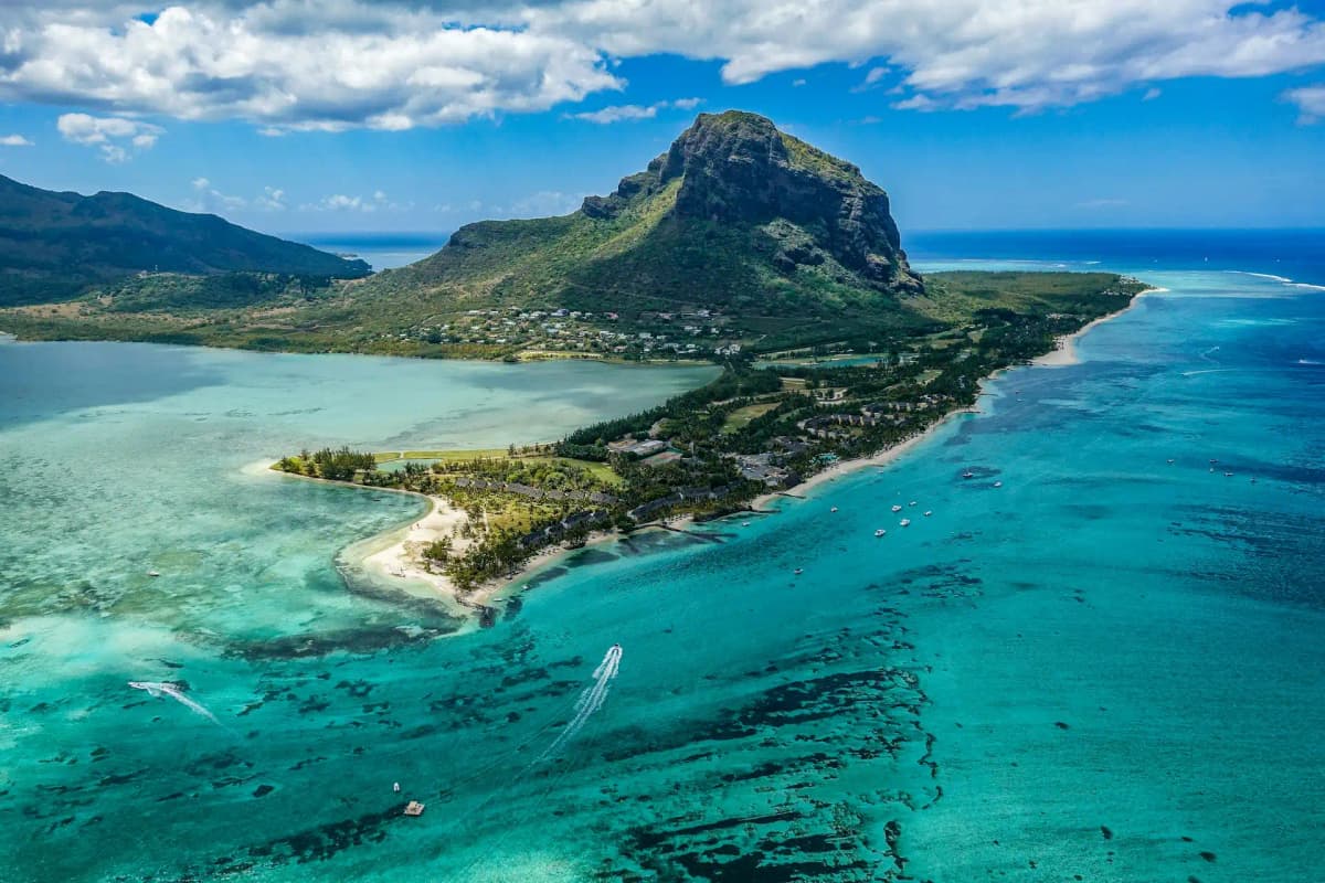
Mauritius landscape

Mauritius

Explore weather trends, climate data, and curated weather guides for Mauritius

Mauritius Climate Intelligence

Situated in the Indian Ocean, Mauritius boasts a tropical climate perfect for year-round exploration. With warm, humid summers from November to April and mild, dry winters from May to October, this island paradise offers consistent sunshine and pleasant temperatures. Planning your perfect Mauritian getaway or need precise data for your business? Explore WeatherBox for detailed weather insights to ensure your trip or operations run smoothly.

Average Temperature & Seasonal Trends in Mauritius

How do temperatures shift month-by-month?

Temperature Map

How to Use This Map

  • Watch Seasons Change

    Click the Play button to start an animated timelapse of annual temperature shifts.

  • Explore Month-by-Month

    Drag the slider controls to pause on specific months and visualize detailed conditions.

Key Summary
  • Mauritius enjoys a warm tropical maritime climate with two main seasons: a humid, hotter wet summer from November to April, and a cooler, drier winter from May to October.
  • Coastal areas stay warm year-round, while the elevated central highlands bring noticeably cooler air, especially during winter nights.
  • The WeatherBox temperature map highlights how east and south coasts are often refreshed by persistent trade winds, whereas north and west shores tend to be warmer and more sheltered.

The air temperature in Mauritius rarely swings to uncomfortable extremes, thanks to the moderating influence of the surrounding Indian Ocean. Annual daytime highs along the coast typically range from 28°C to 32°C (82°F to 90°F) in the wet summer months, dipping to a comfortable 22°C to 26°C (72°F to 79°F) during the drier winter. Sea breezes soften the tropical heat, but humidity can feel intense during January and February, when warm moisture-laden air envelopes the island. As the WeatherBox temperature map illustrates, the warmest readings cluster in the north and west, where sheltered lagoons and leeward positions reduce wind flow. Between seasons, transitional months like April and October feature a blend of sunny spells and brief showers, with temperatures hovering in an agreeable middle ground that many visitors find appealing.

Regional differences in Mauritius stem directly from its compact but varied topography. The central plateau, which rises to elevations around 600 metres (2,000 feet) near towns such as Curepipe, creates a notable temperature drop compared to the beaches. Here, afternoon highs in summer tend to sit between 24°C and 28°C (75°F to 82°F), while winter nights can slip to a cool 12°C to 15°C (54°F to 59°F). This makes the cooler highlands a welcome retreat from coastal mugginess, with misty mornings among the tea plantations of Bois Chéri and gentle walks inside the Black River Gorges. On the eastern and southern shores, persistent trade winds drive a fresher feel and carry more airborne moisture, feeding lush greenery and sometimes bringing cloudy skies. The west and north coasts, by contrast, enjoy warmer, calmer conditions that lend themselves to lazy beach days in spots like Flic-en-Flac. During the peak of the wet season, tropical cyclones occasionally pass near Mauritius, delivering episodes of heavy rain and gusty winds.

For travel plans, the dry winter (May to October) is widely regarded as the most comfortable window, offering clear skies, lower humidity, and temperatures that suit active days spent exploring botanical gardens, sugar estates, and coastal villages without feeling overheated. The sunniest weather often graces the north and west during this period, making those regions ideal for snorkelling in calm lagoons. The wet summer season can be hot and sticky, yet it transforms the island into a brilliantly green landscape and warms the sea to bathtub-like temperatures near 28°C (82°F), which some swimmers actively seek. Packing light, breathable fabrics is sensible throughout the year, but tucking in a light jacket or cotton sweater for central highland evenings and sudden summer downpours is a practical precaution. Sun protection remains essential in every month. By cross-referencing our temperature map with your itinerary, you can pick the microclimate that fits your holiday style. For deeper data and planning insights, explore our full set of Mauritius temperature charts at WeatherBox.

Regional Humidity & Dew Point Patterns in Mauritius

How does humidity vary across the country?

Humidity Map

Key Summary
  • Mauritius has a tropical maritime climate with humidity levels that stay high year-round, swinging from comfortable in the austral winter to very muggy or oppressive during the cyclone season.
  • The island’s topography creates sharp regional contrasts, with the windward east coast and central plateau receiving persistent moisture while the sheltered west coast enjoys brighter, less muggy conditions.
  • The most agreeable window for travel runs from May to October, when lower humidity makes outdoor exploration reliably pleasant.

Mauritius sits in the warm southwest Indian Ocean, where plenty of sunshine and moist ocean air set the stage for a perennially humid atmosphere. Throughout the year, relative humidity readings regularly settle between 70 and 90 percent, though the feel of the air shifts noticeably with the seasons. Our WeatherBox charts capture a reliable split: during the austral summer from November to April, the island falls under the influence of tropical lows and occasional cyclones, pushing moisture to stubbornly high levels. This is when large parts of the coast and interior turn very muggy, with peak months like January and February often feeling oppressive. By contrast, the cooler season from May to October brings lower dew points and a much more comfortable feel, particularly in coastal areas. The WeatherBox humidity comfort index map reflects this seasonal rhythm, with extensive muggy zones during the warmest months that shrink noticeably once the southeast trade winds strengthen.

Geography amplifies these patterns in ways you can feel on your skin. The central plateau around Curepipe and Vacoas, elevated on ancient volcanic terrain, is frequently wrapped in low cloud and delicate drizzle, giving the highlands a damp, cool character. This is where you find the drizzle-soaked tea plantations of Bois Chéri, often blanketed in a fine mist that perfumes the air with fresh, earthy notes. The east and south coasts face the full force of the southeast trade winds, which sustain persistent humidity and regular showers that feed emerald botanical gardens such as Sir Seewoosagur Ramgoolam Botanical Garden. Refer to the WeatherBox humidity map to see these windward stretches marked by higher discomfort readings. In contrast, the leeward west coast around Flic-en-Flac basks in a rain shadow, receiving gloriously clear skies and noticeably lower humidity. This dry-side character makes it a favourite for dolphin-watching trips in Tamarin Bay, where crisp mornings feel lighter even during the wetter months.

When planning your visit, the May to October period stands out as the most rewarding season. Daytime temperatures remain warm, yet the air carries a comfortable freshness that invites long coastal walks at Le Morne, gentle nature trails in Black River Gorges National Park, and relaxed explorations of Port Louis markets without the draining stickiness that defines the summer months. If you do travel from November to April, you encounter a landscape at its most vibrant, but the very muggy conditions demand realistic preparation. Lightweight, breathable fabrics, a sturdy raincoat for sudden tropical downpours, and robust sun protection will go a long way in either season. Even the steamiest afternoon is part of the island’s lush, rain-washed charm. For detailed monthly breakdowns and to see how the comfort index shifts across the island, explore WeatherBox. Our humidity map and corresponding data give you the straightforward insights needed to time your trip for the kind of tropical escape you have in mind.

How to Use This Map

Humidity Comfort Levels
Dry
Comfortable
Uncomfortable
Muggy
Very Muggy
Oppressive
  • Watch Seasons Change

    Click the Play button to start an animated timelapse of annual humidity shifts.

  • Explore Month-by-Month

    Drag the slider controls to pause on specific months and visualize detailed conditions.

  • Find Your Comfort Zone

    Use these insights to identify the ideal time to visit Mauritius based on your weather preferences.

Climate Zones of Mauritius (Köppen-Geiger Map)

What are the climate zones of Mauritius?

Climate Map

Climate Classification Legend

Tropical
Af
Am
Aw
As
Dry
BWh
BWk
BSh
BSk
Temperate
Csa
Csb
Csc
Cwa
Cwb
Cwc
Cfa
Cfb
Cfc
Continental
Dsa
Dsb
Dsc
Dsd
Dwa
Dwb
Dwc
Dwd
Dfa
Dfb
Dfc
Dfd
Polar
ET
EF
Key Summary
  • Mauritius has a tropical monsoon climate (Köppen Am) along its coasts, with a warm, wet summer season from November to April and a cooler, drier winter from May to October.
  • The central highlands create distinct rain shadows: the windward east and south coasts are lush and rain-prone, while the northwest and west coasts enjoy sunnier, drier conditions.
  • Tropical cyclones can strike the island between December and March, bringing intense rain and gusty winds, though Mauritius is small enough for systems to pass quickly.

Mauritius sits just north of the Tropic of Capricorn, surrounded by the vast warm Indian Ocean. This location gives the island a predominantly tropical climate with a strong monsoon signature. The Köppen system classifies most of the coastal lowlands as Am, a tropical monsoon climate, where mean monthly temperatures typically hover between 22°C (72°F) in winter and 28°C (82°F) in summer. What makes this climate intriguing is the seasonal shift driven by the southeast trade winds. During the southern hemisphere summer, these winds deliver generous moisture, triggering afternoon cloudbursts and prolonged heavy showers, especially on the windward slopes. The central plateau, rising to over 600 metres, experiences a noticeably different regime. Places like Curepipe and Vacoas officially fall under a subtropical highland climate (Cfb) with mild temperatures and nights that can dip to a refreshing 12°C to 15°C (54°F to 59°F) in the driest months. The surrounding ocean modulates temperature extremes, so you will rarely feel truly cold, but the interior’s persistent drizzle and mist give it an almost temperate feel.

Geography sharply divides Mauritius into wet and dry zones. The mountains and central volcanic massif intercept the dominant southeast trade winds, wringing out moisture along the eastern coastline and southern shores. This windward side, home to the dazzling Belle Mare beach and the cluster of islets around Île aux Cerfs, is often washed by brief, heavy tropical rainfall even during the dry winter months. The landscape here is brilliantly green, and the rain sustains the dense forests of the Black River Gorges. In contrast, the western and northern regions, including popular Grand Baie and the sun-drenched Flic en Flac, lie in a pronounced rain shadow. These leeward coasts are notably drier and sunnier, receiving roughly half the rainfall of the east. The dry winter period from June to September brings gloriously clear skies and delightful touring weather, with humidity dropping low enough to make a round of golf or an afternoon exploring the historic sugar estates exceptionally comfortable. By November, the humidity begins to climb as the monsoon pattern re-establishes itself, culminating in the warmest, wettest spell from January to March, when tropical cyclones can disrupt beach days with fierce thunderstorms and stubbornly high humidity.

For travel planning, the most pleasant window stretches from May to December, with a sweet spot in September and October when the trade winds are gentle, sea temperatures remain inviting, and the central highlands’ drizzle-soaked tea plantations put on their best green show. The cyclone season from late December through March is the suboptimal period: you can certainly enjoy lush scenery and lower room rates, but the risk of several days of stormy weather and oppressive moisture is real. Regardless of the season, pack light, breathable fabrics, sturdy sun protection, and a quality rain jacket because tropical rainfall can sweep in without much warning even on the sheltered west coast. If you plan to explore the cooler highlands or dine outdoors in Curepipe, a light sweater is wise. The beauty of Mauritius lies in its small size: when the windward coast is cloudy, a short drive often leads to sunnier conditions. At WeatherBox, we provide interactive charts and long-range climate data that break down rainfall, temperature, and cyclone patterns for every corner of the island. Explore our detailed Mauritius climate page to transform these broad patterns into a personalised, day-by-day travel strategy.
Find places with your ideal climate

Use our Climate Finder to search and rank locations by their temperature and humidity patterns.

Open Climate Finder

Compare Weather
in Mauritius

See how temperatures, sunshine, and rainfall differ between any two locations on Earth

Mauritius flag
Port LouisMauritius
Change
Mauritius flag
GoodlandsMauritius
Change

Weather Guides

Explore comprehensive annual weather and climate insights for 6 locations in Mauritius

Explore other locations in Africa