Key Summary- Peru’s climate is ruled by the Andes Mountains and the cold Humboldt Current, creating three starkly different zones: a narrow coastal desert, a seasonal highland, and a tropical rainforest basin in the east.
- The coast is a Köppen BWh/BWn desert strip with mild temperatures, overcast skies in winter, and almost no rain, while the highlands experience a Cwb subtropical highland climate with distinct wet and dry seasons.
- Travel conditions peak during the dry season from May to October across the highlands, with clear skies for outdoor sightseeing, though the Amazon and coast have their own comfortable windows.
Peru sits just south of the equator, but its climate is anything but uniformly tropical. The cold Humboldt Current sweeps along the coastline, cooling the air and suppressing rainfall, which shapes a narrow coastal desert classified under the Köppen BWh and BWn codes north of about 14°S latitude. Here, cities like Lima and Trujillo see cloudy, damp-feeling skies from June to November despite minimal precipitation, while summer months from December to March bring sunnier, warmer days typically ranging from 25°C to 30°C (77°F to 86°F). Inland, the Andes rise abruptly to over 4,000 metres, creating a staircase of climates. Valleys and mid-elevation cities such as Cusco fall into the Cwb subtropical highland type, with warm, bright days and chilly nights year-round. Higher up, puna grasslands edge into ET tundra territory, where frosts are common. East of the continental divide, the land tumbles into the Amazon basin, where Af tropical rainforest and Am monsoon climates dominate, bringing high humidity, abundant rainfall, and stubbornly high temperatures that hover between 24°C and 32°C (75°F to 90°F).
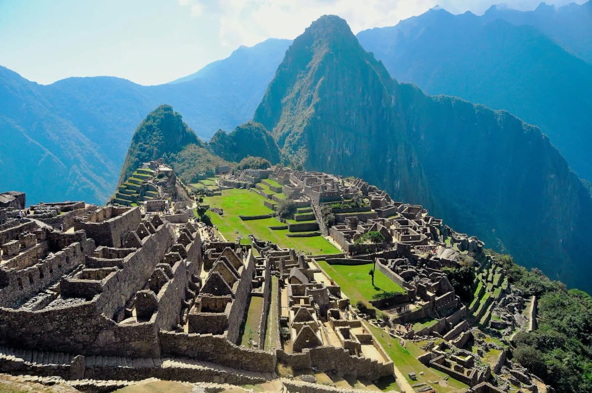
The regional contrasts matter immensely for planning. In the dry coastal desert, the misty “garúa” season from June to November obscures the sun over Lima. The Andean highlands operate on a rhythmic wet season from November to March, when afternoon downpours can swell rivers and cloud over views of the mist-shrouded Inca citadel of Machu Picchu. The dry season from May to October delivers gloriously clear skies for exploring colonial squares and market towns, though nights at altitude dip close to freezing, so layers are essential. In the tropical rainforest of the Amazon, it is always warm and humid. The high water season roughly from December to May opens flooded forest channels for canoe-based wildlife watching near Iquitos or Puerto Maldonado, while the so-called drier stretch from June to September still sees rain but offers better hiking trails and fewer mosquitoes. Over on Lake Titicaca’s vast, reflective surface, the high-altitude sun can be intense year-round, and night-time temperatures routinely sink below 0°C (32°F), so sun protection and insulated layers are both necessary.
For a single trip that samples multiple faces of Peru, the dry season months of June through August are the most forgiving, aligning with crisp Andean days, manageable Amazon showers, and the coastal winter’s atmospheric gloom rather than heavy rain. A lightweight rain jacket and breathable fabrics serve you well in the rainforest and during mountain cloudbursts, while a fleece and warm hat make early mornings in Cusco or lakeside Puno comfortable. The coast between December and March calls for sun hats, sunglasses, and light cottons, though the same period in the highlands brings steady afternoon rainfall that can occasionally disrupt travel. The sheer climatic variety packed into one country means you might never pack perfectly for everywhere at once, but understanding Peru through its Köppen zones lets you choose the right window for the places you most want to see. We invite you to explore WeatherBox’s interactive Köppen maps, monthly temperature graphs, and rainfall charts to fine-tune your itinerary before you go.