World > Asia > Turkey

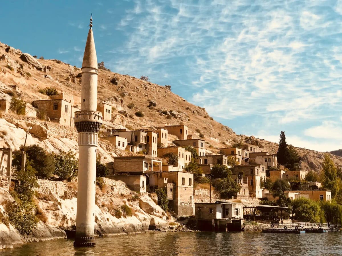
Turkey landscape

Turkey

Explore weather trends, climate data, and curated weather guides for Turkey

Average Temperature & Seasonal Trends in Turkey

How do temperatures shift month-by-month?

Temperature Map

How to Use This Map

  • Watch Seasons Change

    Click the Play button to start an animated timelapse of annual temperature shifts.

  • Explore Month-by-Month

    Drag the slider controls to pause on specific months and visualize detailed conditions.

Key Summary
  • Turkey’s vast geography produces sharp temperature contrasts, with sun-drenched Mediterranean coasts and a stark continental interior where winters are freezing.
  • The damp Black Sea shores support lush tea plantations under mild, rainy skies, while eastern highlands remain snowbound for months before short hot summers arrive.
  • Spring and autumn deliver the most pleasant touring conditions across most regions, while summer brings intense heat to the south-west and winter locks the east in deep cold.

Stretching between Europe and Asia, Turkey spans a climatic crossroads that confounds simple generalizations. As the WeatherBox temperature map illustrates, coastal zones along the Aegean and Mediterranean enjoy a classic hot-summer Mediterranean rhythm: air temperatures in high season typically reach 30°C to 35°C (86°F to 95°F), tempered by refreshing sea breezes, while winter days hover around a mild 10°C to 15°C (50°F to 59°F). Move inland onto the Central Anatolian plateau and the picture shifts dramatically. Ankara, Konya, and the fairy chimney landscape of Cappadocia sit high above sea level, where a continental climate bites hard. Summers here are hot and dry, often climbing into the low 30s Celsius (upper 80s Fahrenheit), but winters can plunge well below -10°C (14°F), turning the steppe into a stark, frozen expanse. Further east, towards Erzurum and Van, altitudes climb higher, dragging winter lows towards -20°C (-4°F) and blocking warm maritime air entirely. This internal diversity means that any trip needs a regional lens from the outset.

These temperature patterns are intimately tied to Turkey’s topography. The Black Sea coast, walled off by the Pontic Mountains, traps moisture from the sea and stays cool and damp year-round. Summer highs here rarely exceed 22°C to 27°C (72°F to 81°F), and frequent rain feeds the drizzle-soaked tea plantations of Rize and Trabzon, where the air feels washed and fresh. By contrast, the sheltered Mediterranean and Aegean littoral basks under gloriously clear skies for much of the year, making it ideal for ancient Lycian ruin-hopping or swimming from late spring into early autumn. Central Anatolia’s high plateau amplifies seasonal extremes: spring brings crisp air and wildflowers to the steppe, while summer heat builds relentlessly, and winter often dusts Cappadocia’s rock cones with snow. The far east, with peaks like Mount Ararat, sees winter snowpack lasting into May and broiling but brief summers. Refer to the WeatherBox temperature map to see how quickly these microclimates shift over short distances.

For travel planning, spring (April to May) and autumn (September to October) offer the most broadly comfortable windows. Air temperatures across the heartland and coasts typically range from 15°C to 25°C (59°F to 77°F), ideal for exploring Istanbul’s bazaars or wandering ancient Ephesus without the crush of high-season heat. Summer (June to August) is the optimal beach season along the turquoise southwest, but inland cities and the southeast can become sweltering, so lightweight breathable fabrics, strong sun protection, and midday shade are essential. Winter travel splits in two: coastal Antalya and Izmir remain mild enough for a relaxed off-season stroll, but the interior and east demand heavy insulated clothing and sturdy footwear for heavy snow and sub-zero temperatures. Packing should mirror your route: layers and a raincoat for the Black Sea coast, warm jackets for any plateau stopover from October onward. Ultimately, Turkey’s mosaic of climates means you can find a favourable setting almost any time of year with the right regional focus. For deeper temperature breakdowns and seasonal maps to fine-tune your itinerary, explore the full dataset on WeatherBox.
Regional Humidity & Dew Point Patterns in Turkey

How does humidity vary across the country?

Humidity Map

Key Summary
  • Coastal regions experience significant variations in moisture levels compared to the arid central Anatolian plateau.
  • The northern Black Sea coast maintains high humidity year-round, while the southern Mediterranean coast peaks during the summer months.
  • High mountain ranges act as a natural barrier that prevents moist maritime air from reaching the interior, creating distinct climate zones.

Turkey’s unique position between the Mediterranean, Aegean, and Black Seas creates a diverse humidity profile that influences local comfort levels throughout the year. We analyze these trends through WeatherBox data to assist travelers in selecting the most suitable time for their visit. Generally, the coastal fringes maintain higher moisture levels compared to the inland regions. During the summer months, the warm waters surrounding the country contribute to uncomfortable humidity levels, particularly along the southern coastline. In contrast, the central plains often remain dry, providing a different experience of the summer heat. As indicated by the WeatherBox humidity map, the transition between these zones is often abrupt, as the country’s significant mountain ranges block the flow of moist air into the interior.

Regional variations are quite pronounced across the Turkish landscape. The northern coastline along the Black Sea is characterized by a humid subtropical climate where the air frequently feels muggy. This consistent moisture supports the lush vegetation and the verdant, mist-covered tea plantations of the northeast. Further south, along the turquoise waters of Antalya and Marmaris, the summer air can become very muggy, which may make midday exploration feel more taxing. Refer to the WeatherBox humidity map to see how these coastal areas contrast with the central landscapes of Cappadocia. In the heart of the country, the lack of maritime influence results in low humidity and a more comfortable atmosphere, offering gloriously clear skies for viewing the unique volcanic rock formations.

Choosing the most favourable conditions for a trip depends on your personal preference for humidity. For those visiting Istanbul or the ancient ruins of Ephesus, the spring and autumn months offer a comfortable balance before the summer moisture reaches its peak. If you travel to the southern coast during July or August, be prepared for periods of oppressive humidity that are best managed by staying near the water or in shaded areas. Packing for these conditions involves selecting light, breathable fabrics such as linen or cotton to stay cool in the heat. Meanwhile, the consistent dampness of the northern coast might necessitate a light raincoat for occasional showers. Our data indicates that late spring provides some of the most optimal weather for a nationwide tour. Explore WeatherBox for more humidity data and detailed insights to help plan your next journey.

How to Use This Map

Humidity Comfort Levels
Dry
Comfortable
Uncomfortable
Muggy
Very Muggy
Oppressive
  • Watch Seasons Change

    Click the Play button to start an animated timelapse of annual humidity shifts.

  • Explore Month-by-Month

    Drag the slider controls to pause on specific months and visualize detailed conditions.

  • Find Your Comfort Zone

    Use these insights to identify the ideal time to visit Turkey based on your weather preferences.

Climate Zones of Turkey (Köppen-Geiger Map)

What are the climate zones of Turkey?

Climate Map

Climate Classification Legend

Tropical
Af
Am
Aw
As
Dry
BWh
BWk
BSh
BSk
Temperate
Csa
Csb
Csc
Cwa
Cwb
Cwc
Cfa
Cfb
Cfc
Continental
Dsa
Dsb
Dsc
Dsd
Dwa
Dwb
Dwc
Dwd
Dfa
Dfb
Dfc
Dfd
Polar
ET
EF
Key Summary
  • Turkey’s geography creates three broad climate zones: a Mediterranean coastline, a wet Black Sea region, and a continental interior with cold winters and hot summers.
  • Dominant Köppen codes include hot-summer Mediterranean (Csa) on the coasts, continental (Dsa, Dfb) on the plateau, and oceanic (Cfb) in the north.
  • Spring and autumn offer mild weather ideal for sightseeing; coastal summers are intensely hot and crowded, and eastern winters are bitterly cold.

Turkey’s climate results from its position between the Mediterranean, Black, and Aegean seas and a high interior plateau ringed by mountains. The western and southern coasts have a classic hot-summer Mediterranean (Csa) climate: sunny, dry summers and mild, wet winters. Inland on the Anatolian plateau, a continental (Dsa, Dfb) climate brings cold, snowy winters and hot, dry summers; much of central Turkey is also cold semi-arid (BSk). On the Black Sea coast, the Pontic Mountains wring moisture from the air, giving year-round rainfall and an oceanic (Cfb) climate with lush, cloud-prone landscapes. This climatic variety means a drive of a few hours can take you from palm-lined coves to snow-covered steppe.

Regional contrasts are vivid. The Turquoise Coast around Antalya and Bodrum bakes under dazzling skies from June to September, with temperatures reaching 30–35°C (86–95°F) and high humidity at the shoreline; winter stays mild and occasionally rainy, ideal for exploring ancient sites without the crowds. The Black Sea region around Trabzon and Rize sees rain throughout the year, nurturing the mist-shrouded tea plantations and hazelnut groves that carpet its steep valleys. Inland Cappadocia’s fairy chimneys and rock-hewn churches sit on a plateau where summer days can reach 30°C (86°F) but nights cool rapidly; winter snow dusts the formations, so warm layers are needed. Further east, around Erzurum and Van, winters are rigorous, with deep snow and temperatures that routinely dip well below -10°C (14°F). Istanbul straddles the boundary, blending Mediterranean summers with occasional winter snow and a touch of the Black Sea’s unpredictability.

For travel, the sweet spots are April to mid-June and September to October. In these months, most of the country enjoys pleasant warmth, low rainfall on the coasts, and manageable conditions for wandering Istanbul’s bazaars or the ruins of Ephesus. The height of summer remains popular for beach holidays on the Mediterranean and Aegean shores, but the heat can be draining and crowds heavy. July and August on the Black Sea coast are warm yet often wet, making them less suited to outdoor exploration. Winter brings heavy snow to the interior and eastern highlands, which appeals to skiers but makes independent travel difficult. Packing accordingly: spring and autumn call for light layers, a rain jacket, and walking shoes; coastal summer demands breathable fabrics, sun protection, and a hat; a winter journey across the plateau requires a heavy coat, gloves, and sturdy boots. Turkey’s climate spans so many zones that you can almost always find a region enjoying beautiful weather. Explore WeatherBox’s maps and monthly data to plan around the conditions you prefer.

Find places with your ideal climate

Use our Climate Finder to search and rank locations by their temperature and humidity patterns.

Open Climate Finder

Compare Weather
in Turkey

See how temperatures, sunshine, and rainfall differ between any two locations on Earth

Turkey flag
IstanbulTurkey
Change
Turkey flag
AnkaraTurkey
Change

Weather Guides

Explore comprehensive annual weather and climate insights for 261 locations in Turkey

Explore other locations in Asia