World > Americas > Trinidad and Tobago

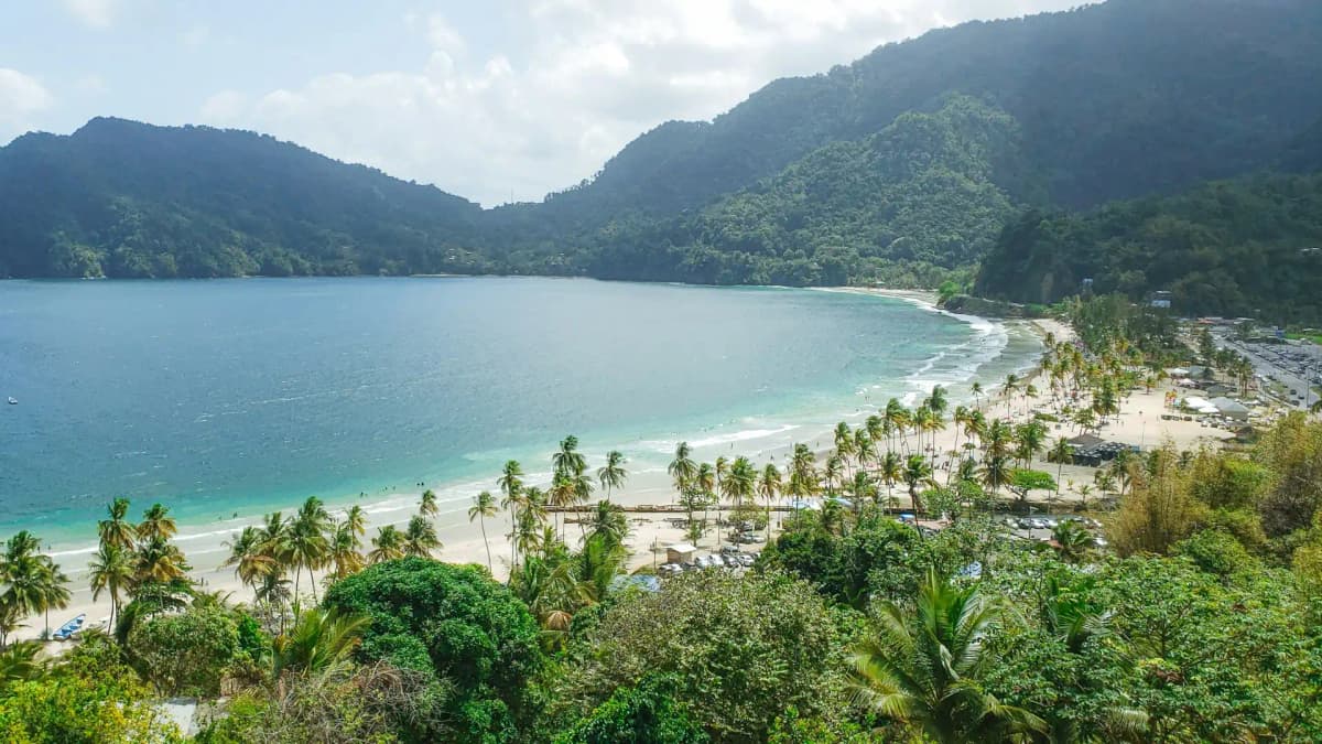
Trinidad and Tobago landscape

Trinidad and Tobago

Explore weather trends, climate data, and curated weather guides for Trinidad and Tobago

Average Temperature & Seasonal Trends in Trinidad and Tobago

How do temperatures shift month-by-month?

Temperature Map

How to Use This Map

  • Watch Seasons Change

    Click the Play button to start an animated timelapse of annual temperature shifts.

  • Explore Month-by-Month

    Drag the slider controls to pause on specific months and visualize detailed conditions.

Key Summary
  • Average daily high temperatures stay between 86°F and 89°F throughout the year, reflecting a very stable and predictable tropical environment.
  • Regional cooling occurs in the elevated Northern Range and across Tobago, where constant sea breezes moderate the typical afternoon heat.

You will find that the air temperature in Trinidad and Tobago stays remarkably consistent across the calendar months. Based on our data at WeatherBox, the islands experience a tropical maritime climate where the mercury rarely fluctuates far from the mid-80s. During the dry season, which runs from January to May, the air feels slightly crisper due to lower humidity levels and the presence of steady northeast trade winds. These winds provide a cooling effect that makes the afternoon heat feel manageable for outdoor activities such as coastal sightseeing or nature photography. As the year progresses into the rainy season starting in June, the ambient temperature remains high, often peaking at 90 degrees Fahrenheit. The increased moisture in the air during these months can make the environment feel significantly warmer than the actual thermometer reading suggests, creating a heavy atmosphere that is common in equatorial regions.

Regional differences across the twin-island nation provide slight variations for those seeking specific conditions. Our WeatherBox maps indicate that the Northern Range in Trinidad offers the most noticeable temperature drop. In these lush highland areas, elevations lead to temperatures that are several degrees cooler than the coastal plains, particularly during the early morning hours when a gentle mist often settles over the peaks. Tobago generally experiences slightly lower maximum temperatures than Trinidad because of its smaller landmass and more direct exposure to ocean breezes that circulate across the island. The urban heat island effect is more prevalent in densely populated areas like Port of Spain, where asphalt and buildings retain thermal energy, leading to warmer evening conditions compared to the rural, forested interior where the natural canopy helps to moderate the daily cycle of warmth.

Planning for the stubbornly high temperatures involves a strategy focused on breathability and timing. Because the afternoon sun is intense, the use of lightweight linen fabrics or moisture-wicking materials supports comfort during midday excursions. People find that the early morning and late evening provide the most pleasant windows for outdoor hiking or beach visits when the air is at its freshest and the sun is lower on the horizon. While the heat is a constant feature, the frequent tropical showers during the second half of the year bring temporary cooling, though they are often followed by a rapid return to steamy conditions as the moisture evaporates. A light layer is a common addition for indoor spaces, which provide a stark transition from the dazzling outdoor warmth captured in our WeatherBox temperature records. Regular hydration is a frequent practice for those navigating the peak afternoon hours to ensure a comfortable experience regardless of the specific month.

Regional Humidity & Dew Point Patterns in Trinidad and Tobago

How does humidity vary across the country?

Humidity Map

Key Summary
  • Humidity levels across Trinidad and Tobago remain consistently high throughout the year, with our data indicating that conditions frequently fall into the muggy and oppressive categories.
  • The dry season offers slight relief via steady trade winds, while the wet season brings saturated air and high moisture levels that peak following afternoon rainfall.

When you step into the tropical atmosphere of these islands, the first thing you notice is the warm moisture that characterizes the Caribbean. We at WeatherBox track these conditions closely to help you prepare for the thick air found throughout the region. Our humidity comfort index indicates that both islands spend a significant portion of the year in the uncomfortable or very muggy zones, particularly when the sun is at its peak. This moisture is a direct result of the surrounding warm ocean waters, which keep dew points high regardless of the month. While the air often feels heavy, it also supports the lush greenery and vibrant ecosystems that make these islands a favorite for nature lovers and outdoor enthusiasts.

Seasonal shifts play a significant role in how the air feels during your stay. During the dry season, which typically runs from January through May, the northeast trade winds provide a cooling breeze that helps circulate the air and makes the stubbornly high humidity more manageable. These winds are especially noticeable on the northern and eastern coasts, where the moving air provides a natural reprieve. However, once the rainy season begins in June, the wind often subsides and the moisture levels rise. We observe on our charts that inland areas, far from the coastal breeze, can experience oppressive conditions after afternoon downpours. These rain events temporarily saturate the ground, and as the water evaporates back into the heat, the air becomes heavy until the next sea breeze arrives.

Navigating this saturated environment is an important part of planning trips or outdoor events. Travelers find that choosing breathable fabrics like linen or high-quality moisture-wicking materials helps them stay comfortable while exploring the coast or the rainforest. Because the humidity remains high even after the sun sets, nighttime temperatures rarely drop significantly, making accommodations with reliable airflow or climate control a popular choice. For those organizing weddings or festivals, the early morning hours often provide the most manageable conditions before the heat of the day drives the humidity levels toward the higher end of our scale. Reference to WeatherBox data ensures that you can fully enjoy the dazzling landscapes and warm island culture by knowing exactly when the air will feel the most comfortable.

How to Use This Map

Humidity Comfort Levels
Dry
Comfortable
Uncomfortable
Muggy
Very Muggy
Oppressive
  • Watch Seasons Change

    Click the Play button to start an animated timelapse of annual humidity shifts.

  • Explore Month-by-Month

    Drag the slider controls to pause on specific months and visualize detailed conditions.

  • Find Your Comfort Zone

    Use these insights to identify the ideal time to visit Trinidad and Tobago based on your weather preferences.

Climate Zones of Trinidad and Tobago (Köppen-Geiger Map)

What are the climate zones of Trinidad and Tobago?

Climate Map

Climate Classification Legend

Tropical
Af
Am
Aw
As
Dry
BWh
BWk
BSh
BSk
Temperate
Csa
Csb
Csc
Cwa
Cwb
Cwc
Cfa
Cfb
Cfc
Continental
Dsa
Dsb
Dsc
Dsd
Dwa
Dwb
Dwc
Dwd
Dfa
Dfb
Dfc
Dfd
Polar
ET
EF
Key Summary
  • Trinidad and Tobago sits just off the Venezuelan coast, with a tropical monsoon climate (Am) that delivers warm temperatures year-round, moderated by steady northeast trade winds.
  • A pronounced dry season from January to May brings lower humidity and sunnier skies, while a long wet season from June to December produces frequent, occasionally torrential showers.
  • The rugged Northern Range of Trinidad and Tobago’s Main Ridge create stark rainfall contrasts, feeding lush rainforest on windward slopes and drier conditions on sheltered leeward coasts.

Trinidad and Tobago’s position between 10° and 11° north latitude places the islands firmly in the tropics, where high humidity and warm air are everyday realities. The dominant climate according to Köppen classification is tropical monsoon (Am), characterised by a distinct drier period and a prolonged rainy spell, with mean lowland temperatures typically ranging from 23°C to 31°C (73°F to 88°F). Small seasonal shifts exist, but the heat is stubborn, easily nudging the feels-like index higher when trades briefly ease. The larger island, Trinidad, flaunts three low mountain chains, most notably the Northern Range, which intercepts moisture-laden winds off the Atlantic and triggers orographic rainfall. Tobago, to the northeast, is defined by the Main Ridge, a volcanic spine that creates a dramatic east-west climate divide. Here on WeatherBox, our climate guides draw on decades of gridded data to map these patterns, so you can visualise the soggy windward slopes and notably brighter rainshadow pockets.

Regional and seasonal distinctions shape how you experience the islands. Trinidad’s east coast and northern hillsides, exposed to the trades, soak up the most rain and stay deeply green, nurturing places like the misty trails of the Northern Range that harbour brilliant birdlife. The central plains and southwest, including the area around the Caroni Swamp where scarlet ibis flock in dazzling numbers, endure a longer, sharper dry season. Tobago’s windward side, wrapped around villages like Charlotteville, can see rainfall totals that edge toward tropical rainforest (Af) conditions, while the leeward southwest coast around Crown Point bakes under reliably sunnier skies between January and May. The wet season arrives in June and lingers through December, broken occasionally by a brief, less-reliable drier spell in September or October. Even within the rains, mornings often start bright, with heavy cloudbursts building by afternoon, so a pre-dawn start remains a favoured rhythm for hikers and birdwatchers. Coastal waters warm to bathtub temperatures, and turtle-nesting beaches along Trinidad’s northeast shores, especially from March to August, are a major draw for nature lovers.

For travel planning, the dry season spanning January through May is widely considered the most favourable window for ease of movement and clear-sky activities. Days stay warm, trade winds keep coastal humidity bearable, and rainfall interruptions are shorter and less frequent. This is an ideal stretch for glass-bottom boat trips over Tobago’s Buccoo Reef or leisurely exploration of Port of Spain’s Botanic Gardens. The wet months, by contrast, bring a quieter, intensely green island landscape but demand flexibility: downpours can be sudden and heavy, turning unpaved roads muddy within minutes. Packing for Trinidad and Tobago almost always calls for lightweight, breathable fabrics, sturdy sun protection, a raincoat that can handle tropical deluges, and insect repellent for still evenings. Even during the peak rainy months, generous sunny spells push through, and the softened light over rainforest canopy is a quiet highlight in itself. Whether you plan to chase the dazzling scarlet ibis at Caroni or unwind on the powdery sands of Pigeon Point, our interactive climate maps and charts at WeatherBox let you explore seasonal rainfall and temperature patterns in detail, helping you pick your window with clearer expectations.
Find places with your ideal climate

Use our Climate Finder to search and rank locations by their temperature and humidity patterns.

Open Climate Finder

Compare Weather
in Trinidad and Tobago

See how temperatures, sunshine, and rainfall differ between any two locations on Earth

Trinidad and Tobago flag
ChaguanasTrinidad and Tobago
Change
Trinidad and Tobago flag
San FernandoTrinidad and Tobago
Change

Weather Guides

Explore comprehensive annual weather and climate insights for 8 locations in Trinidad and Tobago

Explore other locations in Americas